Rágama geodata
Rágama (Castille and León) is a seat of a third-order administrative division; located in Spain in Europe/Madrid (GMT+2) time zone. With population of 268 people, there are 4645 cities with bigger population in this country. Compared to other cities in Spain, 51.6% of cities are located further ↑North; 74.1% of cities are located further →East and 74.4% of cities have lower elevation than Rágama. Note1
Administrative division(s):
- Level 1: Castille and León
- Level 2: Provincia de Salamanca
- Level 3: Rágama


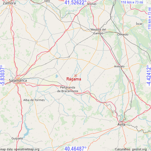
Rágama GPS coordinates[2]
40° 59' 51.648" North, 5° 7' 38.064" West
| Map corner | latitude | longitude |
|---|---|---|
| Upper-left | 41.52622°, | -5.83037° |
| Center: | 40.99768°, | -5.12724° |
| Lower-right: | 40.46487°, | -4.42412° |
| Map W x H: | 118×118 km | = 73.3×73.3mi |
| max Lat: | 43.74134° ⇑51.6% North |
| Rágama: | 40.99768° |
| min Lat: | ⇓48.4% South 27.64134° |
| min Long | Rágama | max Long |
| -18.00367° | -5.12724° | 4.2899° |
| W 25.9%⇐ | ⇒74.1% E |
Elevation
Elevation of Rágama is 847 m = 2779 ft, and this is 249 m = 817 ft above average elevation for this country.
| Max E: |
1682 m = 5518 ft | 25.6% |
| Rágama | 847 m 2779 ft | |
| Avg. | 598 m = 1962 ft | |
Min E: |
0 m = 0 ft | 74.4% |
See also: Spain elevation on elevation.city.
Geographical zone
Rágama is located in North temperate zone (between Tropic of Cancer and the Arctic Circle). Distance of this Northern Tropic circle is 1952.6 km =1213.3 mi to South.| Distance of | km | miles | from Rágama |
|---|---|---|---|
| North Pole | 5448.5 | 3385.5 | to North |
| Arctic Circle | 2842.7 | 1766.4 | to North |
| Tropic Cancer | 1952.6 | 1213.3 | to South |
| Equator | 4558.5 | 2832.5 | to South |


Nearby cities:
15 places around Rágama: (largest is in red/bold)
• Aldeaseca de la Frontera
9.2 km =5.7 mi,  227°
227°
• Cantaracillo
10.9 km =6.8 mi,  196°
196°
• Cisla
10.1 km =6.3 mi,  109°
109°
• Flores de Ávila
8.2 km =5.1 mi,  150°
150°
• Gimialcón
13.4 km =8.3 mi,  178°
178°
• Horcajo de las Torres
8.1 km =5 mi,  22°
22°
• Mamblas
10.2 km =6.3 mi,  76°
76°
• Muñosancho
11.5 km =7.1 mi,  137°
137°
• Palaciosrubios
8.3 km =5.2 mi,  316°
316°
• Paradinas de San Juan
2.8 km =1.7 mi, 234°
• Peñaranda de Bracamonte
12.4 km =7.7 mi,  209°
209°
• Poveda de las Cintas
12.4 km =7.7 mi,  295°
295°
• Rasueros
5.3 km =3.3 mi,  57°
57°
• Villaflores
13.1 km =8.1 mi, 316°
• Zorita de la Frontera
6.1 km =3.8 mi,  287°
287°
Sources, notices
• [Note1] Compared only with cities in Spain existing in our database
• [Src1] Map data: © OpenStreetMap contributors (CC-BY-SA)
• [Src2] Other city data from geonames.org with taken over terms of usage.
• [Src3] Geographical zone / Annual Mean Temperature by Robert A. Rohde @ Wikipedia
