Quintanilla del Coco geodata
Quintanilla del Coco (Castille and León) is a seat of a third-order administrative division; located in Spain in Europe/Madrid (GMT+2) time zone. With population of 104 people, there are 5880 cities with bigger population in this country. Compared to other cities in Spain, 73.3% of cities are located further ↓South; 52.4% of cities are located further →East and 85.7% of cities have lower elevation than Quintanilla del Coco. Note1
Administrative division(s):
- Level 1: Castille and León
- Level 2: Provincia de Burgos
- Level 3: Quintanilla del Coco


Quintanilla del Coco GPS coordinates[2]
41° 58' 59.988" North, 3° 31' 0.012" West
| Map corner | latitude | longitude |
|---|---|---|
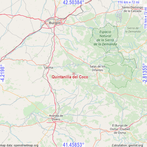
| Upper-left | 42.50384°, | -4.2198° |
| Center: | 41.98333°, | -3.51667° |
| Lower-right: | 41.45853°, | -2.81355° |
| Map W x H: | 116.2×116.2 km | = 72.2×72.2mi |
| max Lat: | 43.74134° ⇑26.7% North |
| Quintanilla del Coco: | 41.98333° |
| min Lat: | ⇓73.3% South 27.64134° |
| min Long | Quintanilla del | max Long |
| -18.00367° | -3.51667° | 4.2899° |
| W 47.6%⇐ | ⇒52.4% E |
Elevation
Elevation of Quintanilla del Coco is 960 m = 3150 ft, and this is 362 m = 1188 ft above average elevation for this country.
| Max E: |
1682 m = 5518 ft | 14.3% |
| Quintanilla del Coco | 960 m 3150 ft | |
| Avg. | 598 m = 1962 ft | |
Min E: |
0 m = 0 ft | 85.7% |
See also: Spain elevation on elevation.city.
Geographical zone
Quintanilla del Coco is located in North temperate zone (between Tropic of Cancer and the Arctic Circle). Distance of this Northern Tropic circle is 2062.2 km =1281.4 mi to South.| Distance of | km | miles | from Quintanilla del Coco |
|---|---|---|---|
| North Pole | 5339 | 3317.5 | to North |
| Arctic Circle | 2733.1 | 1698.3 | to North |
| Tropic Cancer | 2062.2 | 1281.4 | to South |
| Equator | 4668.1 | 2900.6 | to South |


Nearby cities:
15 places around Quintanilla del Coco: (largest is in red/bold)
• Cascajares de la Sierra
13 km =8.1 mi,  48°
48°
• Cebrecos
6.6 km =4.1 mi,  270°
270°
• Ciruelos de Cervera
8.7 km =5.4 mi,  187°
187°
• Contreras
9.7 km =6 mi,  64°
64°
• Covarrubias
8.4 km =5.2 mi,  358°
358°
• Espinosa de Cervera
10.4 km =6.5 mi,  157°
157°
• Hortigüela
12.1 km =7.5 mi,  38°
38°
• Mambrillas de Lara
13.2 km =8.2 mi,  20°
20°
• Nebreda
9.9 km =6.2 mi,  260°
260°
• Puentedura
8.4 km =5.2 mi,  319°
319°
• Retuerta
5.2 km =3.2 mi,  9°
9°
• Santibáñez del Val
3.1 km =1.9 mi,  110°
110°
• Santo Domingo de Silos
8.5 km =5.3 mi,  104°
104°
• Solarana
11.8 km =7.3 mi, 263°
• Tejada
3.8 km =2.4 mi,  204°
204°
Sources, notices
• [Note1] Compared only with cities in Spain existing in our database
• [Src1] Map data: © OpenStreetMap contributors (CC-BY-SA)
• [Src2] Other city data from geonames.org with taken over terms of usage.
• [Src3] Geographical zone / Annual Mean Temperature by Robert A. Rohde @ Wikipedia
