Puentedura geodata
Puentedura (Castille and León) is a seat of a third-order administrative division; located in Spain in Europe/Madrid (GMT+2) time zone. With population of 116 people, there are 5741 cities with bigger population in this country. Compared to other cities in Spain, 74.8% of cities are located further ↓South; 53.4% of cities are located further →East and 76.5% of cities have lower elevation than Puentedura. Note1
Administrative division(s):
- Level 1: Castille and León
- Level 2: Provincia de Burgos
- Level 3: Puentedura


Puentedura GPS coordinates[2]
42° 2' 28.824" North, 3° 34' 56.172" West
| Map corner | latitude | longitude |
|---|---|---|
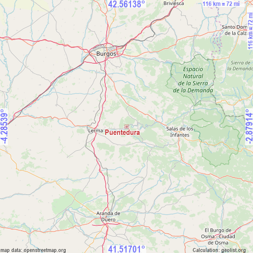
| Upper-left | 42.56138°, | -4.28539° |
| Center: | 42.04134°, | -3.58227° |
| Lower-right: | 41.51701°, | -2.87914° |
| Map W x H: | 116.1×116.1 km | = 72.1×72.1mi |
| max Lat: | 43.74134° ⇑25.2% North |
| Puentedura: | 42.04134° |
| min Lat: | ⇓74.8% South 27.64134° |
| min Long | Puentedura | max Long |
| -18.00367° | -3.58227° | 4.2899° |
| W 46.6%⇐ | ⇒53.4% E |
Elevation
Elevation of Puentedura is 865 m = 2838 ft, and this is 267 m = 876 ft above average elevation for this country.
| Max E: |
1682 m = 5518 ft | 23.5% |
| Puentedura | 865 m 2838 ft | |
| Avg. | 598 m = 1962 ft | |
Min E: |
0 m = 0 ft | 76.5% |
See also: Spain elevation on elevation.city.
Geographical zone
Puentedura is located in North temperate zone (between Tropic of Cancer and the Arctic Circle). Distance of this Northern Tropic circle is 2068.6 km =1285.4 mi to South.| Distance of | km | miles | from Puentedura |
|---|---|---|---|
| North Pole | 5332.5 | 3313.5 | to North |
| Arctic Circle | 2726.6 | 1694.2 | to North |
| Tropic Cancer | 2068.6 | 1285.4 | to South |
| Equator | 4674.6 | 2904.7 | to South |


Nearby cities:
15 places around Puentedura: (largest is in red/bold)
• Cebrecos
6.5 km =4 mi,  190°
190°
• Covarrubias
5.5 km =3.4 mi,  68°
68°
• Cuevas de San Clemente
9.9 km =6.2 mi,  6°
6°
• Hortigüela
13.3 km =8.3 mi,  76°
76°
• Mambrillas de Lara
11.6 km =7.2 mi,  59°
59°
• Mecerreyes
6 km =3.7 mi, 6°
• Nebreda
9.1 km =5.7 mi,  208°
208°
• Quintanilla del Coco
8.4 km =5.2 mi,  139°
139°
• Retuerta
6.4 km =4 mi,  101°
101°
• Santa Inés
10 km =6.2 mi,  269°
269°
• Santibáñez del Val
11.2 km =7 mi,  132°
132°
• Solarana
10 km =6.2 mi,  219°
219°
• Tejada
10.6 km =6.6 mi,  158°
158°
• Torrecilla del Monte
10.9 km =6.8 mi,  302°
302°
• Villalmanzo
13.2 km =8.2 mi, 273°
Sources, notices
• [Note1] Compared only with cities in Spain existing in our database
• [Src1] Map data: © OpenStreetMap contributors (CC-BY-SA)
• [Src2] Other city data from geonames.org with taken over terms of usage.
• [Src3] Geographical zone / Annual Mean Temperature by Robert A. Rohde @ Wikipedia
