Piqueras geodata
Piqueras (Castille-La Mancha) is a seat of a third-order administrative division; located in Spain in Europe/Madrid (GMT+2) time zone. With population of 63 people, there are 6314 cities with bigger population in this country. Compared to other cities in Spain, 58.6% of cities are located further ↑North; 70.3% of cities are located further ←West and 99.3% of cities have lower elevation than Piqueras. Note1
Administrative division(s):
- Level 1: Castille-La Mancha
- Level 2: Provincia de Guadalajara
- Level 3: Piqueras


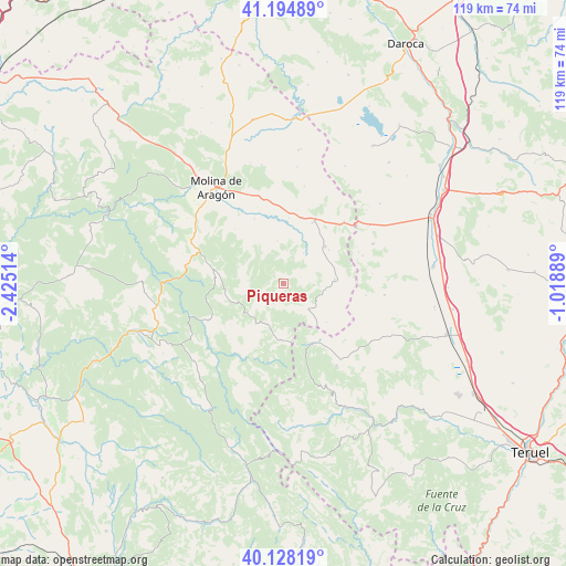
Piqueras GPS coordinates[2]
40° 39' 49.212" North, 1° 43' 19.272" West
| Map corner | latitude | longitude |
|---|---|---|
| Upper-left | 41.19489°, | -2.42514° |
| Center: | 40.66367°, | -1.72202° |
| Lower-right: | 40.12819°, | -1.01889° |
| Map W x H: | 118.6×118.6 km | = 73.7×73.7mi |
| max Lat: | 43.74134° ⇑58.6% North |
| Piqueras: | 40.66367° |
| min Lat: | ⇓41.4% South 27.64134° |
| min Long | Piqueras | max Long |
| -18.00367° | -1.72202° | 4.2899° |
| W 70.3%⇐ | ⇒29.7% E |
Elevation
Elevation of Piqueras is 1373 m = 4505 ft, and this is 775 m = 2543 ft above average elevation for this country.
| Max E: |
1682 m = 5518 ft | 0.7% |
| Piqueras | 1373 m 4505 ft | |
| Avg. | 598 m = 1962 ft | |
Min E: |
0 m = 0 ft | 99.3% |
See also: Spain elevation on elevation.city.
Geographical zone
Piqueras is located in North temperate zone (between Tropic of Cancer and the Arctic Circle). Distance of this Northern Tropic circle is 1915.5 km =1190.2 mi to South.| Distance of | km | miles | from Piqueras |
|---|---|---|---|
| North Pole | 5485.7 | 3408.7 | to North |
| Arctic Circle | 2879.8 | 1789.4 | to North |
| Tropic Cancer | 1915.5 | 1190.2 | to South |
| Equator | 4521.4 | 2809.5 | to South |


Nearby cities:
15 places around Piqueras: (largest is in red/bold)
• Adobes
3.9 km =2.4 mi,  69°
69°
• Alcoroches
4.6 km =2.9 mi,  206°
206°
• Alustante
7.6 km =4.7 mi,  135°
135°
• Anquela del Pedregal
8.9 km =5.5 mi,  351°
351°
• Checa
10.4 km =6.5 mi, 213°
• Chequilla
11 km =6.8 mi,  234°
234°
• Megina
12.8 km =8 mi,  257°
257°
• Morenilla
13.8 km =8.6 mi,  5°
5°
• Orea
11.8 km =7.3 mi,  182°
182°
• Orihuela del Tremedal
14 km =8.7 mi,  154°
154°
• Pinilla de Molina
13.5 km =8.4 mi,  277°
277°
• Setiles
11.8 km =7.3 mi,  48°
48°
• Tordellego
7.8 km =4.8 mi,  34°
34°
• Tordesilos
10.8 km =6.7 mi,  85°
85°
• Torrecuadrada de Molina
11.9 km =7.4 mi,  323°
323°
Sources, notices
• [Note1] Compared only with cities in Spain existing in our database
• [Src1] Map data: © OpenStreetMap contributors (CC-BY-SA)
• [Src2] Other city data from geonames.org with taken over terms of usage.
• [Src3] Geographical zone / Annual Mean Temperature by Robert A. Rohde @ Wikipedia
