Setiles geodata
Setiles (Castille-La Mancha) is a seat of a third-order administrative division; located in Spain in Europe/Madrid (GMT+2) time zone. With population of 149 people, there are 5436 cities with bigger population in this country. Compared to other cities in Spain, 57.4% of cities are located further ↑North; 71.8% of cities are located further ←West and 98.2% of cities have lower elevation than Setiles. Note1
Administrative division(s):
- Level 1: Castille-La Mancha
- Level 2: Provincia de Guadalajara
- Level 3: Setiles


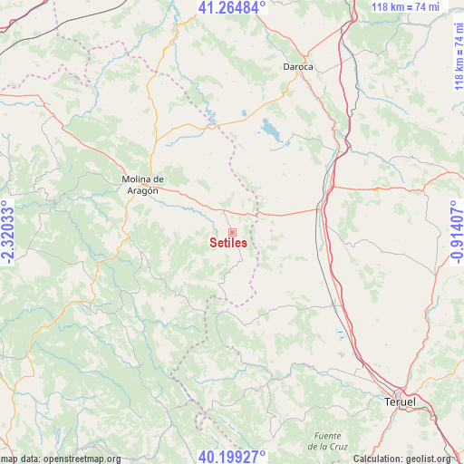
Setiles GPS coordinates[2]
40° 44' 3.084" North, 1° 37' 1.92" West
| Map corner | latitude | longitude |
|---|---|---|
| Upper-left | 41.26484°, | -2.32033° |
| Center: | 40.73419°, | -1.6172° |
| Lower-right: | 40.19927°, | -0.91407° |
| Map W x H: | 118.5×118.5 km | = 73.6×73.6mi |
| max Lat: | 43.74134° ⇑57.4% North |
| Setiles: | 40.73419° |
| min Lat: | ⇓42.6% South 27.64134° |
| min Long | Setiles | max Long |
| -18.00367° | -1.6172° | 4.2899° |
| W 71.8%⇐ | ⇒28.2% E |
Elevation
Elevation of Setiles is 1262 m = 4140 ft, and this is 664 m = 2178 ft above average elevation for this country.
| Max E: |
1682 m = 5518 ft | 1.8% |
| Setiles | 1262 m 4140 ft | |
| Avg. | 598 m = 1962 ft | |
Min E: |
0 m = 0 ft | 98.2% |
See also: Spain elevation on elevation.city.
Geographical zone
Setiles is located in North temperate zone (between Tropic of Cancer and the Arctic Circle). Distance of this Northern Tropic circle is 1923.3 km =1195.1 mi to South.| Distance of | km | miles | from Setiles |
|---|---|---|---|
| North Pole | 5477.8 | 3403.7 | to North |
| Arctic Circle | 2872 | 1784.6 | to North |
| Tropic Cancer | 1923.3 | 1195.1 | to South |
| Equator | 4529.2 | 2814.3 | to South |


Nearby cities:
15 places around Setiles: (largest is in red/bold)
• Adobes
8.3 km =5.2 mi,  218°
218°
• Alustante
13.8 km =8.6 mi,  194°
194°
• Anquela del Pedregal
10.1 km =6.3 mi,  275°
275°
• Blancas
14.4 km =8.9 mi,  52°
52°
• Castellar de la Muela
15.2 km =9.4 mi,  308°
308°
• Hombrados
9.4 km =5.8 mi,  322°
322°
• Morenilla
9.6 km =6 mi, 307°
• Ojos Negros
10 km =6.2 mi,  87°
87°
• Piqueras
11.8 km =7.3 mi,  228°
228°
• Pozuel del Campo
10.3 km =6.4 mi,  66°
66°
• Prados Redondos
15.9 km =9.9 mi,  290°
290°
• Ródenas
13.4 km =8.3 mi,  140°
140°
• Tordellego
4.7 km =2.9 mi,  252°
252°
• Tordesilos
7.3 km =4.5 mi,  164°
164°
• Villar del Salz
11.5 km =7.1 mi,  120°
120°
Sources, notices
• [Note1] Compared only with cities in Spain existing in our database
• [Src1] Map data: © OpenStreetMap contributors (CC-BY-SA)
• [Src2] Other city data from geonames.org with taken over terms of usage.
• [Src3] Geographical zone / Annual Mean Temperature by Robert A. Rohde @ Wikipedia
