Anquela del Pedregal geodata
Anquela del Pedregal (Castille-La Mancha) is a seat of a third-order administrative division; located in Spain in Europe/Madrid (GMT+2) time zone. With population of 21 people, there are 6716 cities with bigger population in this country. Compared to other cities in Spain, 57.2% of cities are located further ↑North; 70.1% of cities are located further ←West and 98.4% of cities have lower elevation than Anquela del Pedregal. Note1
Administrative division(s):
- Level 1: Castille-La Mancha
- Level 2: Provincia de Guadalajara
- Level 3: Anquela del Pedregal


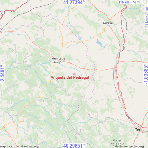
Anquela del Pedregal GPS coordinates[2]
40° 44' 36.096" North, 1° 44' 13.092" West
| Map corner | latitude | longitude |
|---|---|---|
| Upper-left | 41.27394°, | -2.4401° |
| Center: | 40.74336°, | -1.73697° |
| Lower-right: | 40.20851°, | -1.03385° |
| Map W x H: | 118.5×118.5 km | = 73.6×73.6mi |
| max Lat: | 43.74134° ⇑57.2% North |
| Anquela del Pedregal: | 40.74336° |
| min Lat: | ⇓42.8% South 27.64134° |
| min Long | Anquela del Ped | max Long |
| -18.00367° | -1.73697° | 4.2899° |
| W 70.1%⇐ | ⇒29.9% E |
Elevation
Elevation of Anquela del Pedregal is 1283 m = 4209 ft, and this is 685 m = 2247 ft above average elevation for this country.
| Max E: |
1682 m = 5518 ft | 1.6% |
| Anquela del Pedregal | 1283 m 4209 ft | |
| Avg. | 598 m = 1962 ft | |
Min E: |
0 m = 0 ft | 98.4% |
See also: Spain elevation on elevation.city.
Geographical zone
Anquela del Pedregal is located in North temperate zone (between Tropic of Cancer and the Arctic Circle). Distance of this Northern Tropic circle is 1924.3 km =1195.7 mi to South.| Distance of | km | miles | from Anquela del Pedregal |
|---|---|---|---|
| North Pole | 5476.8 | 3403.1 | to North |
| Arctic Circle | 2870.9 | 1783.9 | to North |
| Tropic Cancer | 1924.3 | 1195.7 | to South |
| Equator | 4530.2 | 2814.9 | to South |


Nearby cities:
15 places around Anquela del Pedregal: (largest is in red/bold)
• Adobes
9 km =5.6 mi,  147°
147°
• Alcoroches
13 km =8.1 mi,  183°
183°
• Castellar de la Muela
8.6 km =5.3 mi,  347°
347°
• Castilnuevo
12.9 km =8 mi,  307°
307°
• Hombrados
7.7 km =4.8 mi,  33°
33°
• Morenilla
5.5 km =3.4 mi, 27°
• Pinilla de Molina
14 km =8.7 mi,  239°
239°
• Piqueras
8.9 km =5.5 mi,  171°
171°
• Prados Redondos
6.6 km =4.1 mi, 314°
• Setiles
10.1 km =6.3 mi,  95°
95°
• Terzaga
15.1 km =9.4 mi,  249°
249°
• Tordellego
6.1 km =3.8 mi,  113°
113°
• Tordesilos
14.5 km =9 mi,  123°
123°
• Torrecuadrada de Molina
5.9 km =3.7 mi,  276°
276°
• Torremochuela
9.2 km =5.7 mi,  285°
285°
Sources, notices
• [Note1] Compared only with cities in Spain existing in our database
• [Src1] Map data: © OpenStreetMap contributors (CC-BY-SA)
• [Src2] Other city data from geonames.org with taken over terms of usage.
• [Src3] Geographical zone / Annual Mean Temperature by Robert A. Rohde @ Wikipedia
