Peñacaballera geodata
Peñacaballera (Castille and León) is a seat of a third-order administrative division; located in Spain in Europe/Madrid (GMT+2) time zone. With population of 184 people, there are 5155 cities with bigger population in this country. Compared to other cities in Spain, 65% of cities are located further ↑North; 84.1% of cities are located further →East and 77.6% of cities have lower elevation than Peñacaballera. Note1
Administrative division(s):
- Level 1: Castille and León
- Level 2: Provincia de Salamanca
- Level 3: Peñacaballera


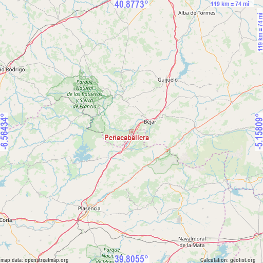
Peñacaballera GPS coordinates[2]
40° 20' 36.708" North, 5° 51' 40.356" West
| Map corner | latitude | longitude |
|---|---|---|
| Upper-left | 40.8773°, | -6.56434° |
| Center: | 40.34353°, | -5.86121° |
| Lower-right: | 39.8055°, | -5.15809° |
| Map W x H: | 119.2×119.2 km | = 74.1×74.1mi |
| max Lat: | 43.74134° ⇑65% North |
| Peñacaballera: | 40.34353° |
| min Lat: | ⇓35% South 27.64134° |
| min Long | Peñacaballera | max Long |
| -18.00367° | -5.86121° | 4.2899° |
| W 15.9%⇐ | ⇒84.1% E |
Elevation
Elevation of Peñacaballera is 875 m = 2871 ft, and this is 277 m = 909 ft above average elevation for this country.
| Max E: |
1682 m = 5518 ft | 22.4% |
| Peñacaballera | 875 m 2871 ft | |
| Avg. | 598 m = 1962 ft | |
Min E: |
0 m = 0 ft | 77.6% |
See also: Spain elevation on elevation.city.
Geographical zone
Peñacaballera is located in North temperate zone (between Tropic of Cancer and the Arctic Circle). Distance of this Northern Tropic circle is 1879.9 km =1168.1 mi to South.| Distance of | km | miles | from Peñacaballera |
|---|---|---|---|
| North Pole | 5521.3 | 3430.8 | to North |
| Arctic Circle | 2915.4 | 1811.5 | to North |
| Tropic Cancer | 1879.9 | 1168.1 | to South |
| Equator | 4485.8 | 2787.3 | to South |


Nearby cities:
15 places around Peñacaballera: (largest is in red/bold)
• Aldeacipreste
5.2 km =3.2 mi,  323°
323°
• Aldeanueva del Camino
10.9 km =6.8 mi,  211°
211°
• Baños de Montemayor
3 km =1.9 mi,  178°
178°
• Béjar
9.6 km =6 mi,  60°
60°
• Candelario
10.2 km =6.3 mi,  74°
74°
• Cantagallo
4.8 km =3 mi,  48°
48°
• Colmenar de Montemayor
10.2 km =6.3 mi,  307°
307°
• El Cerro
5.6 km =3.5 mi,  237°
237°
• Hervás
8.1 km =5 mi, 183°
• Horcajo de Montemayor
9.2 km =5.7 mi,  342°
342°
• La Garganta
3.6 km =2.2 mi,  116°
116°
• Lagunilla
9.6 km =6 mi,  257°
257°
• Montemayor del Río
2.9 km =1.8 mi,  280°
280°
• Puerto de Béjar
2.1 km =1.3 mi, 68°
• Valdehijaderos
8.5 km =5.3 mi,  7°
7°
Sources, notices
• [Note1] Compared only with cities in Spain existing in our database
• [Src1] Map data: © OpenStreetMap contributors (CC-BY-SA)
• [Src2] Other city data from geonames.org with taken over terms of usage.
• [Src3] Geographical zone / Annual Mean Temperature by Robert A. Rohde @ Wikipedia
