Pedraza geodata
Pedraza (Castille and León) is a seat of a third-order administrative division; located in Spain in Europe/Madrid (GMT+2) time zone. With population of 497 people, there are 3897 cities with bigger population in this country. Compared to other cities in Spain, 51.7% of cities are located further ↓South; 56.9% of cities are located further →East and 92.2% of cities have lower elevation than Pedraza. Note1
Administrative division(s):
- Level 1: Castille and León
- Level 2: Provincia de Segovia
- Level 3: Pedraza


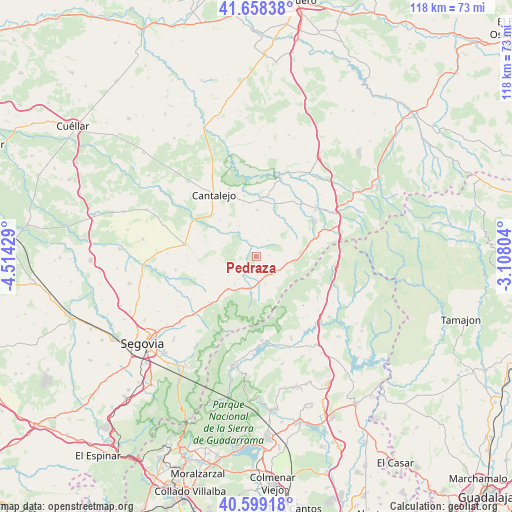
Pedraza GPS coordinates[2]
41° 7' 51.312" North, 3° 48' 40.176" West
| Map corner | latitude | longitude |
|---|---|---|
| Upper-left | 41.65838°, | -4.51429° |
| Center: | 41.13092°, | -3.81116° |
| Lower-right: | 40.59918°, | -3.10804° |
| Map W x H: | 117.8×117.8 km | = 73.2×73.2mi |
| max Lat: | 43.74134° ⇑48.3% North |
| Pedraza: | 41.13092° |
| min Lat: | ⇓51.7% South 27.64134° |
| min Long | Pedraza | max Long |
| -18.00367° | -3.81116° | 4.2899° |
| W 43.1%⇐ | ⇒56.9% E |
Elevation
Elevation of Pedraza is 1073 m = 3520 ft, and this is 475 m = 1558 ft above average elevation for this country.
| Max E: |
1682 m = 5518 ft | 7.8% |
| Pedraza | 1073 m 3520 ft | |
| Avg. | 598 m = 1962 ft | |
Min E: |
0 m = 0 ft | 92.2% |
See also: Spain elevation on elevation.city.
Geographical zone
Pedraza is located in North temperate zone (between Tropic of Cancer and the Arctic Circle). Distance of this Northern Tropic circle is 1967.4 km =1222.5 mi to South.| Distance of | km | miles | from Pedraza |
|---|---|---|---|
| North Pole | 5433.7 | 3376.3 | to North |
| Arctic Circle | 2827.8 | 1757.1 | to North |
| Tropic Cancer | 1967.4 | 1222.5 | to South |
| Equator | 4573.3 | 2841.7 | to South |


Nearby cities:
15 places around Pedraza: (largest is in red/bold)
• Arahuetes
3.9 km =2.4 mi,  281°
281°
• Arcones
7.4 km =4.6 mi,  100°
100°
• Arevalillo de Cega
7.4 km =4.6 mi,  297°
297°
• Castroserna de Abajo
10.8 km =6.7 mi,  36°
36°
• Cubillo
8.2 km =5.1 mi,  262°
262°
• Gallegos
6.6 km =4.1 mi,  161°
161°
• Matabuena
5.9 km =3.7 mi,  131°
131°
• Navafría
8.5 km =5.3 mi,  187°
187°
• Prádena
10.3 km =6.4 mi,  84°
84°
• Puebla de Pedraza
11.9 km =7.4 mi,  314°
314°
• Rebollo
7.9 km =4.9 mi,  330°
330°
• San Pedro de Gaíllos
10.6 km =6.6 mi,  0°
0°
• Torre Val de San Pedro
8 km =5 mi,  219°
219°
• Valleruela de Pedraza
5.4 km =3.4 mi, 3°
• Valleruela de Sepúlveda
7.1 km =4.4 mi,  26°
26°
Sources, notices
• [Note1] Compared only with cities in Spain existing in our database
• [Src1] Map data: © OpenStreetMap contributors (CC-BY-SA)
• [Src2] Other city data from geonames.org with taken over terms of usage.
• [Src3] Geographical zone / Annual Mean Temperature by Robert A. Rohde @ Wikipedia
