Matabuena geodata
Matabuena (Castille and León) is a seat of a third-order administrative division; located in Spain in Europe/Madrid (GMT+2) time zone. With population of 221 people, there are 4905 cities with bigger population in this country. Compared to other cities in Spain, 50.9% of cities are located further ↓South; 56.1% of cities are located further →East and 95.5% of cities have lower elevation than Matabuena. Note1
Administrative division(s):
- Level 1: Castille and León
- Level 2: Provincia de Segovia
- Level 3: Matabuena


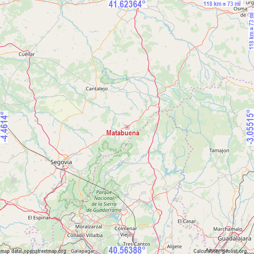
Matabuena GPS coordinates[2]
41° 5' 45.24" North, 3° 45' 29.772" West
| Map corner | latitude | longitude |
|---|---|---|
| Upper-left | 41.62364°, | -4.4614° |
| Center: | 41.0959°, | -3.75827° |
| Lower-right: | 40.56388°, | -3.05515° |
| Map W x H: | 117.8×117.8 km | = 73.2×73.2mi |
| max Lat: | 43.74134° ⇑49.1% North |
| Matabuena: | 41.0959° |
| min Lat: | ⇓50.9% South 27.64134° |
| min Long | Matabuena | max Long |
| -18.00367° | -3.75827° | 4.2899° |
| W 43.9%⇐ | ⇒56.1% E |
Elevation
Elevation of Matabuena is 1152 m = 3780 ft, and this is 554 m = 1818 ft above average elevation for this country.
| Max E: |
1682 m = 5518 ft | 4.5% |
| Matabuena | 1152 m 3780 ft | |
| Avg. | 598 m = 1962 ft | |
Min E: |
0 m = 0 ft | 95.5% |
See also: Spain elevation on elevation.city.
Geographical zone
Matabuena is located in North temperate zone (between Tropic of Cancer and the Arctic Circle). Distance of this Northern Tropic circle is 1963.5 km =1220.1 mi to South.| Distance of | km | miles | from Matabuena |
|---|---|---|---|
| North Pole | 5437.6 | 3378.8 | to North |
| Arctic Circle | 2831.7 | 1759.5 | to North |
| Tropic Cancer | 1963.5 | 1220.1 | to South |
| Equator | 4569.4 | 2839.3 | to South |


Nearby cities:
15 places around Matabuena: (largest is in red/bold)
• Arahuetes
9.5 km =5.9 mi,  299°
299°
• Arcones
3.8 km =2.4 mi,  49°
49°
• Braojos
11.4 km =7.1 mi,  122°
122°
• Casla
11.6 km =7.2 mi, 47°
• Castroserna de Abajo
12.7 km =7.9 mi,  9°
9°
• Cubillo
12.9 km =8 mi,  282°
282°
• Gallegos
3.3 km =2.1 mi,  225°
225°
• Gascones
13 km =8.1 mi,  131°
131°
• Navafría
7.2 km =4.5 mi, 230°
• Pedraza
5.9 km =3.7 mi,  311°
311°
• Prádena
7.6 km =4.7 mi, 50°
• Torre Val de San Pedro
9.7 km =6 mi,  256°
256°
• Valleruela de Pedraza
10.1 km =6.3 mi,  336°
336°
• Valleruela de Sepúlveda
10.3 km =6.4 mi,  353°
353°
• Villavieja del Lozoya
12.7 km =7.9 mi,  143°
143°
Sources, notices
• [Note1] Compared only with cities in Spain existing in our database
• [Src1] Map data: © OpenStreetMap contributors (CC-BY-SA)
• [Src2] Other city data from geonames.org with taken over terms of usage.
• [Src3] Geographical zone / Annual Mean Temperature by Robert A. Rohde @ Wikipedia
