Gallegos geodata
Gallegos (Castille and León) is a seat of a third-order administrative division; located in Spain in Europe/Madrid (GMT+2) time zone. With population of 100 people, there are 5934 cities with bigger population in this country. Compared to other cities in Spain, 50.3% of cities are located further ↓South; 56.5% of cities are located further →East and 97.7% of cities have lower elevation than Gallegos. Note1
Administrative division(s):
- Level 1: Castille and León
- Level 2: Provincia de Segovia
- Level 3: Gallegos


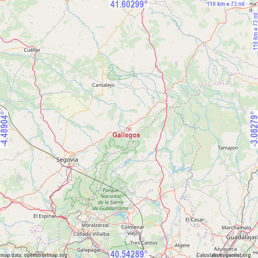
Gallegos GPS coordinates[2]
41° 4' 30.288" North, 3° 47' 9.276" West
| Map corner | latitude | longitude |
|---|---|---|
| Upper-left | 41.60299°, | -4.48904° |
| Center: | 41.07508°, | -3.78591° |
| Lower-right: | 40.54289°, | -3.08279° |
| Map W x H: | 117.9×117.9 km | = 73.3×73.3mi |
| max Lat: | 43.74134° ⇑49.7% North |
| Gallegos: | 41.07508° |
| min Lat: | ⇓50.3% South 27.64134° |
| min Long | Gallegos | max Long |
| -18.00367° | -3.78591° | 4.2899° |
| W 43.5%⇐ | ⇒56.5% E |
Elevation
Elevation of Gallegos is 1237 m = 4058 ft, and this is 639 m = 2096 ft above average elevation for this country.
| Max E: |
1682 m = 5518 ft | 2.3% |
| Gallegos | 1237 m 4058 ft | |
| Avg. | 598 m = 1962 ft | |
Min E: |
0 m = 0 ft | 97.7% |
See also: Spain elevation on elevation.city.
Geographical zone
Gallegos is located in North temperate zone (between Tropic of Cancer and the Arctic Circle). Distance of this Northern Tropic circle is 1961.2 km =1218.6 mi to South.| Distance of | km | miles | from Gallegos |
|---|---|---|---|
| North Pole | 5439.9 | 3380.2 | to North |
| Arctic Circle | 2834.1 | 1761 | to North |
| Tropic Cancer | 1961.2 | 1218.6 | to South |
| Equator | 4567.1 | 2837.9 | to South |


Nearby cities:
15 places around Gallegos: (largest is in red/bold)
• Arahuetes
9.1 km =5.7 mi,  319°
319°
• Arcones
7.1 km =4.4 mi,  47°
47°
• Arevalillo de Cega
12.9 km =8 mi, 318°
• Braojos
12.6 km =7.8 mi,  107°
107°
• Collado Hermoso
11.8 km =7.3 mi,  250°
250°
• Cubillo
11.5 km =7.1 mi,  296°
296°
• Matabuena
3.3 km =2.1 mi, 45°
• Navafría
3.9 km =2.4 mi,  235°
235°
• Pedraza
6.6 km =4.1 mi,  341°
341°
• Pelayos del Arroyo
13.3 km =8.3 mi,  258°
258°
• Prádena
10.8 km =6.7 mi, 48°
• Torre Val de San Pedro
7.1 km =4.4 mi,  270°
270°
• Valleruela de Pedraza
11.7 km =7.3 mi,  351°
351°
• Valleruela de Sepúlveda
12.6 km =7.8 mi,  5°
5°
• Villavieja del Lozoya
12.6 km =7.8 mi,  128°
128°
Sources, notices
• [Note1] Compared only with cities in Spain existing in our database
• [Src1] Map data: © OpenStreetMap contributors (CC-BY-SA)
• [Src2] Other city data from geonames.org with taken over terms of usage.
• [Src3] Geographical zone / Annual Mean Temperature by Robert A. Rohde @ Wikipedia
