Navafría geodata
Navafría (Castille and León) is a seat of a third-order administrative division; located in Spain in Europe/Madrid (GMT+2) time zone. With population of 345 people, there are 4330 cities with bigger population in this country. Compared to other cities in Spain, 50.2% of cities are located further ↑North; 57.2% of cities are located further →East and 96.9% of cities have lower elevation than Navafría. Note1
Administrative division(s):
- Level 1: Castille and León
- Level 2: Provincia de Segovia
- Level 3: Navafría


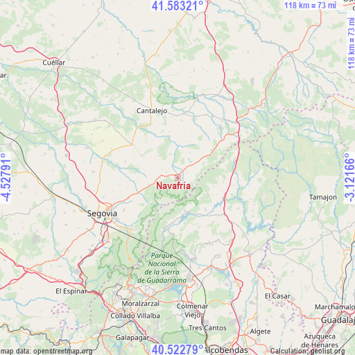
Navafría GPS coordinates[2]
41° 3' 18.504" North, 3° 49' 29.208" West
| Map corner | latitude | longitude |
|---|---|---|
| Upper-left | 41.58321°, | -4.52791° |
| Center: | 41.05514°, | -3.82478° |
| Lower-right: | 40.52279°, | -3.12166° |
| Map W x H: | 117.9×117.9 km | = 73.3×73.3mi |
| max Lat: | 43.74134° ⇑50.2% North |
| Navafría: | 41.05514° |
| min Lat: | ⇓49.8% South 27.64134° |
| min Long | Navafría | max Long |
| -18.00367° | -3.82478° | 4.2899° |
| W 42.8%⇐ | ⇒57.2% E |
Elevation
Elevation of Navafría is 1201 m = 3940 ft, and this is 603 m = 1978 ft above average elevation for this country.
| Max E: |
1682 m = 5518 ft | 3.1% |
| Navafría | 1201 m 3940 ft | |
| Avg. | 598 m = 1962 ft | |
Min E: |
0 m = 0 ft | 96.9% |
See also: Spain elevation on elevation.city.
Geographical zone
Navafría is located in North temperate zone (between Tropic of Cancer and the Arctic Circle). Distance of this Northern Tropic circle is 1959 km =1217.3 mi to South.| Distance of | km | miles | from Navafría |
|---|---|---|---|
| North Pole | 5442.2 | 3381.6 | to North |
| Arctic Circle | 2836.3 | 1762.4 | to North |
| Tropic Cancer | 1959 | 1217.3 | to South |
| Equator | 4564.9 | 2836.5 | to South |


Nearby cities:
15 places around Navafría: (largest is in red/bold)
• Arahuetes
9.6 km =6 mi,  343°
343°
• Arcones
11 km =6.8 mi,  50°
50°
• Arevalillo de Cega
13 km =8.1 mi, 335°
• Caballar
13.8 km =8.6 mi,  302°
302°
• Collado Hermoso
8.1 km =5 mi,  256°
256°
• Cubillo
10.2 km =6.3 mi,  316°
316°
• Gallegos
3.9 km =2.4 mi,  55°
55°
• La Cuesta
11.8 km =7.3 mi,  285°
285°
• Lozoya
12.1 km =7.5 mi,  166°
166°
• Matabuena
7.2 km =4.5 mi, 50°
• Pedraza
8.5 km =5.3 mi,  7°
7°
• Pelayos del Arroyo
9.8 km =6.1 mi,  267°
267°
• Sotosalbos
10 km =6.2 mi, 257°
• Torre Val de San Pedro
4.5 km =2.8 mi, 300°
• Valleruela de Pedraza
13.9 km =8.6 mi, 6°
Sources, notices
• [Note1] Compared only with cities in Spain existing in our database
• [Src1] Map data: © OpenStreetMap contributors (CC-BY-SA)
• [Src2] Other city data from geonames.org with taken over terms of usage.
• [Src3] Geographical zone / Annual Mean Temperature by Robert A. Rohde @ Wikipedia
