Pedrajas de San Esteban geodata
Pedrajas de San Esteban (Castille and León) is a seat of a third-order administrative division; located in Spain in Europe/Madrid (GMT+2) time zone. With population of 3,349 people, there are 1623 cities with bigger population in this country. Compared to other cities in Spain, 56.1% of cities are located further ↓South; 67.2% of cities are located further →East and 61.5% of cities have lower elevation than Pedrajas de San Esteban. Note1
Administrative division(s):
- Level 1: Castille and León
- Level 2: Provincia de Valladolid
- Level 3: Pedrajas de San Esteban
Current local time in Pedrajas de San Esteban:
09:17 PM, ThursdayDifference from your time zone: hours


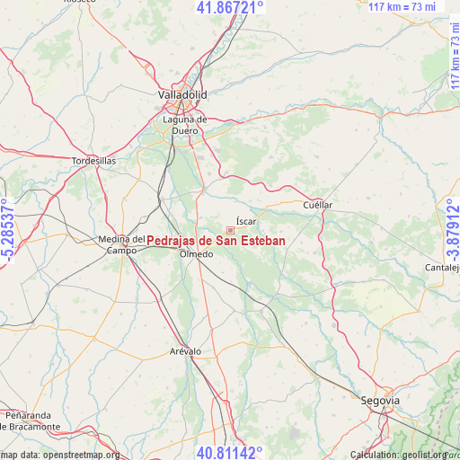
Pedrajas de San Esteban GPS coordinates[2]
41° 20' 29.22" North, 4° 34' 56.1" West
| Map corner | latitude | longitude |
|---|---|---|
| Upper-left | 41.86721°, | -5.28537° |
| Center: | 41.34145°, | -4.58225° |
| Lower-right: | 40.81142°, | -3.87912° |
| Map W x H: | 117.4×117.4 km | = 72.9×72.9mi |
| max Lat: | 43.74134° ⇑43.9% North |
| Pedrajas de San Esteban: | 41.34145° |
| min Lat: | ⇓56.1% South 27.64134° |
| min Long | Pedrajas de San | max Long |
| -18.00367° | -4.58225° | 4.2899° |
| W 32.8%⇐ | ⇒67.2% E |
Elevation
Elevation of Pedrajas de San Esteban is 754 m = 2474 ft, and this is 156 m = 512 ft above average elevation for this country.
| Max E: |
1682 m = 5518 ft | 38.5% |
| Pedrajas de San Esteban | 754 m 2474 ft | |
| Avg. | 598 m = 1962 ft | |
Min E: |
0 m = 0 ft | 61.5% |
See also: Spain elevation on elevation.city.
Geographical zone
Pedrajas de San Esteban is located in North temperate zone (between Tropic of Cancer and the Arctic Circle). Distance of this Northern Tropic circle is 1990.8 km =1237 mi to South.| Distance of | km | miles | from Pedrajas de San Esteban |
|---|---|---|---|
| North Pole | 5410.3 | 3361.8 | to North |
| Arctic Circle | 2804.4 | 1742.6 | to North |
| Tropic Cancer | 1990.8 | 1237 | to South |
| Equator | 4596.7 | 2856.3 | to South |


Nearby cities:
15 places around Pedrajas de San Esteban: (largest is in red/bold)
• Aguasal
9.5 km =5.9 mi,  218°
218°
• Alcazarén
8.2 km =5.1 mi,  293°
293°
• Aldea de San Miguel
13.6 km =8.5 mi,  348°
348°
• Chañe
12.9 km =8 mi,  91°
91°
• Fresneda de Cuéllar
11.4 km =7.1 mi,  102°
102°
• Iscar
4.6 km =2.9 mi,  61°
61°
• Llano de Olmedo
8.7 km =5.4 mi,  197°
197°
• Mata de Cuéllar
11.1 km =6.9 mi, 56°
• Megeces
7.6 km =4.7 mi,  13°
13°
• Mojados
12.2 km =7.6 mi,  325°
325°
• Olmedo
10.8 km =6.7 mi,  235°
235°
• Remondo
8.2 km =5.1 mi, 90°
• Vallelado
14.7 km =9.1 mi, 61°
• Villaverde de Iscar
6 km =3.7 mi,  130°
130°
• Villeguillo
9.8 km =6.1 mi,  178°
178°
Sources, notices
• [Note1] Compared only with cities in Spain existing in our database
• [Src1] Map data: © OpenStreetMap contributors (CC-BY-SA)
• [Src2] Other city data from geonames.org with taken over terms of usage.
• [Src3] Geographical zone / Annual Mean Temperature by Robert A. Rohde @ Wikipedia
