Padrones de Bureba geodata
Padrones de Bureba (Castille and León) is a seat of a third-order administrative division; located in Spain in Europe/Madrid (GMT+2) time zone. With population of 58 people, there are 6374 cities with bigger population in this country. Compared to other cities in Spain, 91.5% of cities are located further ↓South; 52.7% of cities are located further →East and 64.8% of cities have lower elevation than Padrones de Bureba. Note1
Administrative division(s):
- Level 1: Castille and León
- Level 2: Provincia de Burgos
- Level 3: Padrones de Bureba


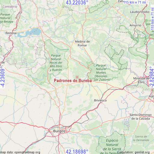
Padrones de Bureba GPS coordinates[2]
42° 42' 20.952" North, 3° 31' 58.656" West
| Map corner | latitude | longitude |
|---|---|---|
| Upper-left | 43.22036°, | -4.23609° |
| Center: | 42.70582°, | -3.53296° |
| Lower-right: | 42.18698°, | -2.82984° |
| Map W x H: | 114.9×114.9 km | = 71.4×71.4mi |
| max Lat: | 43.74134° ⇑8.5% North |
| Padrones de Bureba: | 42.70582° |
| min Lat: | ⇓91.5% South 27.64134° |
| min Long | Padrones de Bur | max Long |
| -18.00367° | -3.53296° | 4.2899° |
| W 47.3%⇐ | ⇒52.7% E |
Elevation
Elevation of Padrones de Bureba is 776 m = 2546 ft, and this is 178 m = 584 ft above average elevation for this country.
| Max E: |
1682 m = 5518 ft | 35.2% |
| Padrones de Bureba | 776 m 2546 ft | |
| Avg. | 598 m = 1962 ft | |
Min E: |
0 m = 0 ft | 64.8% |
See also: Spain elevation on elevation.city.
Geographical zone
Padrones de Bureba is located in North temperate zone (between Tropic of Cancer and the Arctic Circle). Distance of this Northern Tropic circle is 2142.5 km =1331.3 mi to South.| Distance of | km | miles | from Padrones de Bureba |
|---|---|---|---|
| North Pole | 5258.6 | 3267.5 | to North |
| Arctic Circle | 2652.7 | 1648.3 | to North |
| Tropic Cancer | 2142.5 | 1331.3 | to South |
| Equator | 4748.4 | 2950.5 | to South |


Nearby cities:
15 places around Padrones de Bureba: (largest is in red/bold)
• Abajas
10 km =6.2 mi,  203°
203°
• Cantabrana
6.2 km =3.9 mi,  59°
59°
• Carcedo de Bureba
14.5 km =9 mi,  168°
168°
• Llano de Bureba
10.9 km =6.8 mi,  146°
146°
• Navas de Bureba
17.1 km =10.6 mi,  99°
99°
• Oña
10.2 km =6.3 mi,  72°
72°
• Piérnigas
16.1 km =10 mi,  142°
142°
• Poza de la Sal
5.2 km =3.2 mi, 150°
• Quintanabureba
19 km =11.8 mi,  134°
134°
• Rojas
16.1 km =10 mi, 152°
• Rublacedo de Abajo
17.1 km =10.6 mi, 171°
• Rucandio
5.1 km =3.2 mi,  351°
351°
• Salas de Bureba
5.1 km =3.2 mi,  107°
107°
• Sedano
17.8 km =11.1 mi,  273°
273°
• Trespaderne
15.9 km =9.9 mi,  47°
47°
Sources, notices
• [Note1] Compared only with cities in Spain existing in our database
• [Src1] Map data: © OpenStreetMap contributors (CC-BY-SA)
• [Src2] Other city data from geonames.org with taken over terms of usage.
• [Src3] Geographical zone / Annual Mean Temperature by Robert A. Rohde @ Wikipedia
