Sedano geodata
Sedano (Castille and León) is a populated place; located in Spain in Europe/Madrid (GMT+2) time zone. With population of 534 people, there are 3774 cities with bigger population in this country. Compared to other cities in Spain, 91.7% of cities are located further ↓South; 56% of cities are located further →East and 60.3% of cities have lower elevation than Sedano. Note1
Administrative division(s):
- Level 1: Castille and León
- Level 2: Provincia de Burgos
- Level 3: Valle de Sedano


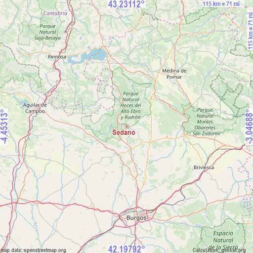
Sedano GPS coordinates[2]
42° 43' 0.012" North, 3° 45' 0" West
| Map corner | latitude | longitude |
|---|---|---|
| Upper-left | 43.23112°, | -4.45313° |
| Center: | 42.71667°, | -3.75° |
| Lower-right: | 42.19792°, | -3.04688° |
| Map W x H: | 114.9×114.9 km | = 71.4×71.4mi |
| max Lat: | 43.74134° ⇑8.3% North |
| Sedano: | 42.71667° |
| min Lat: | ⇓91.7% South 27.64134° |
| min Long | Sedano | max Long |
| -18.00367° | -3.75° | 4.2899° |
| W 44%⇐ | ⇒56% E |
Elevation
Elevation of Sedano is 747 m = 2451 ft, and this is 149 m = 489 ft above average elevation for this country.
| Max E: |
1682 m = 5518 ft | 39.7% |
| Sedano | 747 m 2451 ft | |
| Avg. | 598 m = 1962 ft | |
Min E: |
0 m = 0 ft | 60.3% |
See also: Spain elevation on elevation.city.
Geographical zone
Sedano is located in North temperate zone (between Tropic of Cancer and the Arctic Circle). Distance of this Northern Tropic circle is 2143.7 km =1332 mi to South.| Distance of | km | miles | from Sedano |
|---|---|---|---|
| North Pole | 5257.4 | 3266.8 | to North |
| Arctic Circle | 2651.5 | 1647.6 | to North |
| Tropic Cancer | 2143.7 | 1332 | to South |
| Equator | 4749.6 | 2951.3 | to South |


Nearby cities:
15 places around Sedano: (largest is in red/bold)
• Abajas
17.3 km =10.7 mi,  126°
126°
• Basconcillos del Tozo
19.6 km =12.2 mi,  265°
265°
• Berzosilla
24.5 km =15.2 mi,  286°
286°
• Cantabrana
23.2 km =14.4 mi,  85°
85°
• Carcedo de Bureba
25.7 km =16 mi, 126°
• Huérmeces
21.7 km =13.5 mi,  184°
184°
• Llano de Bureba
25.9 km =16.1 mi,  113°
113°
• Montorio
14.8 km =9.2 mi,  188°
188°
• Padrones de Bureba
17.8 km =11.1 mi, 93°
• Poza de la Sal
21.1 km =13.1 mi, 105°
• Rucandio
17.4 km =10.8 mi,  77°
77°
• Salas de Bureba
22.8 km =14.2 mi,  96°
96°
• San Martín de Elines
15.8 km =9.8 mi,  322°
322°
• Sargentes de la Lora
11.6 km =7.2 mi,  300°
300°
• Tubilla del Agua
4.3 km =2.7 mi,  258°
258°
Sources, notices
• [Note1] Compared only with cities in Spain existing in our database
• [Src1] Map data: © OpenStreetMap contributors (CC-BY-SA)
• [Src2] Other city data from geonames.org with taken over terms of usage.
• [Src3] Geographical zone / Annual Mean Temperature by Robert A. Rohde @ Wikipedia
