Armuña geodata
Armuña (Castille and León) is a seat of a third-order administrative division; located in Spain in Europe/Madrid (GMT+2) time zone. With population of 244 people, there are 4780 cities with bigger population in this country. Compared to other cities in Spain, 50.4% of cities are located further ↓South; 64.1% of cities are located further →East and 81.1% of cities have lower elevation than Armuña. Note1
Administrative division(s):
- Level 1: Castille and León
- Level 2: Provincia de Segovia
- Level 3: Armuña


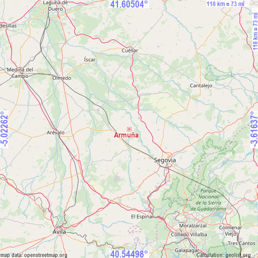
Armuña GPS coordinates[2]
41° 4' 37.74" North, 4° 19' 10.164" West
| Map corner | latitude | longitude |
|---|---|---|
| Upper-left | 41.60504°, | -5.02262° |
| Center: | 41.07715°, | -4.31949° |
| Lower-right: | 40.54498°, | -3.61637° |
| Map W x H: | 117.9×117.9 km | = 73.3×73.3mi |
| max Lat: | 43.74134° ⇑49.6% North |
| Armuña: | 41.07715° |
| min Lat: | ⇓50.4% South 27.64134° |
| min Long | Armuña | max Long |
| -18.00367° | -4.31949° | 4.2899° |
| W 35.9%⇐ | ⇒64.1% E |
Elevation
Elevation of Armuña is 908 m = 2979 ft, and this is 310 m = 1017 ft above average elevation for this country.
| Max E: |
1682 m = 5518 ft | 18.9% |
| Armuña | 908 m 2979 ft | |
| Avg. | 598 m = 1962 ft | |
Min E: |
0 m = 0 ft | 81.1% |
See also: Spain elevation on elevation.city.
Geographical zone
Armuña is located in North temperate zone (between Tropic of Cancer and the Arctic Circle). Distance of this Northern Tropic circle is 1961.4 km =1218.8 mi to South.| Distance of | km | miles | from Armuña |
|---|---|---|---|
| North Pole | 5439.7 | 3380.1 | to North |
| Arctic Circle | 2833.8 | 1760.8 | to North |
| Tropic Cancer | 1961.4 | 1218.8 | to South |
| Equator | 4567.4 | 2838 | to South |


Nearby cities:
15 places around Armuña: (largest is in red/bold)
• Anaya
9.5 km =5.9 mi,  174°
174°
• Añe
4.9 km =3 mi,  154°
154°
• Bernardos
6.2 km =3.9 mi,  334°
334°
• Carbonero el Mayor
6.8 km =4.2 mi,  42°
42°
• Domingo García
6.6 km =4.1 mi,  310°
310°
• Escarabajosa de Cabezas
10.9 km =6.8 mi,  73°
73°
• Garcillán
11.9 km =7.4 mi,  157°
157°
• Marazuela
11.6 km =7.2 mi,  199°
199°
• Migueláñez
6.2 km =3.9 mi,  322°
322°
• Nieva
8.9 km =5.5 mi,  273°
273°
• Ortigosa de Pestaño
6.4 km =4 mi,  280°
280°
• Roda de Eresma
12.8 km =8 mi,  115°
115°
• Santa María la Real de Nieva
7.4 km =4.6 mi,  263°
263°
• Tabanera la Luenga
7 km =4.3 mi, 72°
• Yanguas de Eresma
6.8 km =4.2 mi,  94°
94°
Sources, notices
• [Note1] Compared only with cities in Spain existing in our database
• [Src1] Map data: © OpenStreetMap contributors (CC-BY-SA)
• [Src2] Other city data from geonames.org with taken over terms of usage.
• [Src3] Geographical zone / Annual Mean Temperature by Robert A. Rohde @ Wikipedia
