Manzaneda geodata
Manzaneda (Galicia) is a seat of a third-order administrative division; located in Spain in Europe/Madrid (GMT+2) time zone. With population of 1,139 people, there are 2783 cities with bigger population in this country. Compared to other cities in Spain, 82% of cities are located further ↓South; 94.8% of cities are located further →East and 50.2% of cities have lower elevation than Manzaneda. Note1


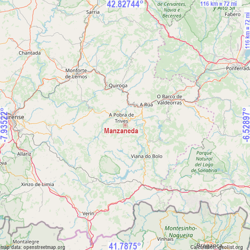
Manzaneda GPS coordinates[2]
42° 18' 34.632" North, 7° 13' 55.524" West
| Map corner | latitude | longitude |
|---|---|---|
| Upper-left | 42.82744°, | -7.93522° |
| Center: | 42.30962°, | -7.23209° |
| Lower-right: | 41.7875°, | -6.52897° |
| Map W x H: | 115.6×115.6 km | = 71.8×71.8mi |
| max Lat: | 43.74134° ⇑18% North |
| Manzaneda: | 42.30962° |
| min Lat: | ⇓82% South 27.64134° |
| min Long | Manzaneda | max Long |
| -18.00367° | -7.23209° | 4.2899° |
| W 5.2%⇐ | ⇒94.8% E |
Elevation
Elevation of Manzaneda is 661 m = 2169 ft, and this is 63 m = 207 ft above average elevation for this country.
| Max E: |
1682 m = 5518 ft | 49.8% |
| Manzaneda | 661 m 2169 ft | |
| Avg. | 598 m = 1962 ft | |
Min E: |
0 m = 0 ft | 50.2% |
See also: Spain elevation on elevation.city.
Geographical zone
Manzaneda is located in North temperate zone (between Tropic of Cancer and the Arctic Circle). Distance of this Northern Tropic circle is 2098.5 km =1303.9 mi to South.| Distance of | km | miles | from Manzaneda |
|---|---|---|---|
| North Pole | 5302.7 | 3294.9 | to North |
| Arctic Circle | 2696.8 | 1675.7 | to North |
| Tropic Cancer | 2098.5 | 1303.9 | to South |
| Equator | 4704.4 | 2923.2 | to South |


Nearby cities:
15 places around Manzaneda: (largest is in red/bold)
• A Pobra do Brollon
30.4 km =18.9 mi,  334°
334°
• A Rúa
14.7 km =9.1 mi,  46°
46°
• Castro Caldelas
17.4 km =10.8 mi,  294°
294°
• Laza
33.5 km =20.8 mi,  214°
214°
• Lobios
26.9 km =16.7 mi, 293°
• Monforte de Lemos
33 km =20.5 mi,  315°
315°
• Montederramo
22.5 km =14 mi,  260°
260°
• O Barco de Valdeorras
23.2 km =14.4 mi,  59°
59°
• Petín
11.7 km =7.3 mi, 46°
• Pobra de Trives
3.7 km =2.3 mi, 332°
• Porto
31.6 km =19.6 mi,  120°
120°
• Pías
31.6 km =19.6 mi,  142°
142°
• Quiroga
18.9 km =11.7 mi,  349°
349°
• Sober
33.6 km =20.9 mi,  300°
300°
• Vilariño de Conso
16.4 km =10.2 mi,  165°
165°
Sources, notices
• [Note1] Compared only with cities in Spain existing in our database
• [Src1] Map data: © OpenStreetMap contributors (CC-BY-SA)
• [Src2] Other city data from geonames.org with taken over terms of usage.
• [Src3] Geographical zone / Annual Mean Temperature by Robert A. Rohde @ Wikipedia
