Malaguilla geodata
Malaguilla (Castille-La Mancha) is a seat of a third-order administrative division; located in Spain in Europe/Madrid (GMT+2) time zone. With population of 136 people, there are 5534 cities with bigger population in this country. Compared to other cities in Spain, 55.7% of cities are located further ↑North; 50.9% of cities are located further ←West and 69.7% of cities have lower elevation than Malaguilla. Note1
Administrative division(s):
- Level 1: Castille-La Mancha
- Level 2: Provincia de Guadalajara
- Level 3: Malaguilla


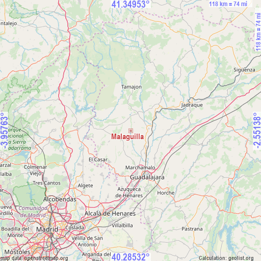
Malaguilla GPS coordinates[2]
40° 49' 10.416" North, 3° 15' 16.2" West
| Map corner | latitude | longitude |
|---|---|---|
| Upper-left | 41.34953°, | -3.95763° |
| Center: | 40.81956°, | -3.2545° |
| Lower-right: | 40.28532°, | -2.55138° |
| Map W x H: | 118.3×118.3 km | = 73.5×73.5mi |
| max Lat: | 43.74134° ⇑55.7% North |
| Malaguilla: | 40.81956° |
| min Lat: | ⇓44.3% South 27.64134° |
| min Long | Malaguilla | max Long |
| -18.00367° | -3.2545° | 4.2899° |
| W 50.9%⇐ | ⇒49.1% E |
Elevation
Elevation of Malaguilla is 812 m = 2664 ft, and this is 214 m = 702 ft above average elevation for this country.
| Max E: |
1682 m = 5518 ft | 30.3% |
| Malaguilla | 812 m 2664 ft | |
| Avg. | 598 m = 1962 ft | |
Min E: |
0 m = 0 ft | 69.7% |
See also: Spain elevation on elevation.city.
Geographical zone
Malaguilla is located in North temperate zone (between Tropic of Cancer and the Arctic Circle). Distance of this Northern Tropic circle is 1932.8 km =1201 mi to South.| Distance of | km | miles | from Malaguilla |
|---|---|---|---|
| North Pole | 5468.4 | 3397.9 | to North |
| Arctic Circle | 2862.5 | 1778.7 | to North |
| Tropic Cancer | 1932.8 | 1201 | to South |
| Equator | 4538.7 | 2820.2 | to South |


Nearby cities:
15 places around Malaguilla: (largest is in red/bold)
• Alarilla
13.1 km =8.1 mi,  76°
76°
• Casa de Uceda
9.9 km =6.2 mi,  284°
284°
• Fontanar
12.6 km =7.8 mi,  146°
146°
• Fuentelahiguera de Albatages
5.9 km =3.7 mi,  226°
226°
• Humanes
8.6 km =5.3 mi,  85°
85°
• Matarrubia
5.8 km =3.6 mi,  329°
329°
• Mohernando
7.2 km =4.5 mi,  106°
106°
• Málaga del Fresno
3.7 km =2.3 mi,  166°
166°
• Puebla de Beleña
8.3 km =5.2 mi,  22°
22°
• Robledillo de Mohernando
4 km =2.5 mi,  28°
28°
• Taragudo
15 km =9.3 mi, 89°
• Valdepeñas de la Sierra
14.5 km =9 mi,  311°
311°
• Villaseca de Uceda
8 km =5 mi,  268°
268°
• Viñuelas
7.8 km =4.8 mi,  247°
247°
• Yunquera de Henares
10.8 km =6.7 mi,  134°
134°
Sources, notices
• [Note1] Compared only with cities in Spain existing in our database
• [Src1] Map data: © OpenStreetMap contributors (CC-BY-SA)
• [Src2] Other city data from geonames.org with taken over terms of usage.
• [Src3] Geographical zone / Annual Mean Temperature by Robert A. Rohde @ Wikipedia
