Viñuelas geodata
Viñuelas (Castille-La Mancha) is a seat of a third-order administrative division; located in Spain in Europe/Madrid (GMT+2) time zone. With population of 117 people, there are 5732 cities with bigger population in this country. Compared to other cities in Spain, 56.3% of cities are located further ↑North; 50% of cities are located further ←West and 76.7% of cities have lower elevation than Viñuelas. Note1
Administrative division(s):
- Level 1: Castille-La Mancha
- Level 2: Provincia de Guadalajara
- Level 3: Viñuelas


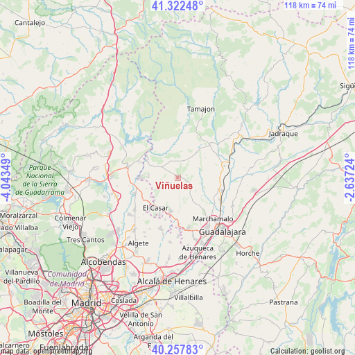
Viñuelas GPS coordinates[2]
40° 47' 32.244" North, 3° 20' 25.296" West
| Map corner | latitude | longitude |
|---|---|---|
| Upper-left | 41.32248°, | -4.04349° |
| Center: | 40.79229°, | -3.34036° |
| Lower-right: | 40.25783°, | -2.63724° |
| Map W x H: | 118.4×118.4 km | = 73.6×73.6mi |
| max Lat: | 43.74134° ⇑56.3% North |
| Viñuelas: | 40.79229° |
| min Lat: | ⇓43.7% South 27.64134° |
| min Long | Viñuelas | max Long |
| -18.00367° | -3.34036° | 4.2899° |
| W 50%⇐ | ⇒50% E |
Elevation
Elevation of Viñuelas is 868 m = 2848 ft, and this is 270 m = 886 ft above average elevation for this country.
| Max E: |
1682 m = 5518 ft | 23.3% |
| Viñuelas | 868 m 2848 ft | |
| Avg. | 598 m = 1962 ft | |
Min E: |
0 m = 0 ft | 76.7% |
See also: Spain elevation on elevation.city.
Geographical zone
Viñuelas is located in North temperate zone (between Tropic of Cancer and the Arctic Circle). Distance of this Northern Tropic circle is 1929.8 km =1199.1 mi to South.| Distance of | km | miles | from Viñuelas |
|---|---|---|---|
| North Pole | 5471.4 | 3399.8 | to North |
| Arctic Circle | 2865.5 | 1780.5 | to North |
| Tropic Cancer | 1929.8 | 1199.1 | to South |
| Equator | 4535.7 | 2818.4 | to South |


Nearby cities:
15 places around Viñuelas: (largest is in red/bold)
• Casa de Uceda
5.9 km =3.7 mi,  336°
336°
• Fuentelahiguera de Albatages
3.2 km =2 mi,  108°
108°
• Galápagos
11 km =6.8 mi,  177°
177°
• Malaguilla
7.8 km =4.8 mi,  67°
67°
• Matarrubia
9.1 km =5.7 mi,  28°
28°
• Mohernando
14.2 km =8.8 mi,  85°
85°
• Málaga del Fresno
8.1 km =5 mi, 93°
• Patones
14.1 km =8.8 mi,  300°
300°
• Ribatejada
14.8 km =9.2 mi,  196°
196°
• Robledillo de Mohernando
11.3 km =7 mi,  54°
54°
• Torremocha de Jarama
14.2 km =8.8 mi,  292°
292°
• Uceda
11.4 km =7.1 mi, 297°
• Valdepeñas de la Sierra
13.1 km =8.1 mi, 343°
• Valdepiélagos
10.9 km =6.8 mi,  249°
249°
• Villaseca de Uceda
3 km =1.9 mi,  345°
345°
Sources, notices
• [Note1] Compared only with cities in Spain existing in our database
• [Src1] Map data: © OpenStreetMap contributors (CC-BY-SA)
• [Src2] Other city data from geonames.org with taken over terms of usage.
• [Src3] Geographical zone / Annual Mean Temperature by Robert A. Rohde @ Wikipedia
