Junciana geodata
Junciana (Castille and León) is a seat of a third-order administrative division; located in Spain in Europe/Madrid (GMT+2) time zone. With population of 81 people, there are 6123 cities with bigger population in this country. Compared to other cities in Spain, 63.8% of cities are located further ↑North; 79.5% of cities are located further →East and 88.1% of cities have lower elevation than Junciana. Note1
Administrative division(s):
- Level 1: Castille and León
- Level 2: Provincia de Ávila
- Level 3: Junciana


Junciana GPS coordinates[2]
40° 24' 38.736" North, 5° 33' 25.128" West
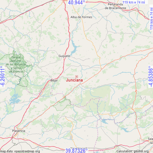
| Map corner | latitude | longitude |
|---|---|---|
| Upper-left | 40.944°, | -6.26011° |
| Center: | 40.41076°, | -5.55698° |
| Lower-right: | 39.87326°, | -4.85386° |
| Map W x H: | 119.1×119.1 km | = 74×74mi |
| max Lat: | 43.74134° ⇑63.8% North |
| Junciana: | 40.41076° |
| min Lat: | ⇓36.2% South 27.64134° |
| min Long | Junciana | max Long |
| -18.00367° | -5.55698° | 4.2899° |
| W 20.5%⇐ | ⇒79.5% E |
Elevation
Elevation of Junciana is 1000 m = 3281 ft, and this is 402 m = 1319 ft above average elevation for this country.
| Max E: |
1682 m = 5518 ft | 11.9% |
| Junciana | 1000 m 3281 ft | |
| Avg. | 598 m = 1962 ft | |
Min E: |
0 m = 0 ft | 88.1% |
See also: Spain elevation on elevation.city.
Geographical zone
Junciana is located in North temperate zone (between Tropic of Cancer and the Arctic Circle). Distance of this Northern Tropic circle is 1887.3 km =1172.7 mi to South.| Distance of | km | miles | from Junciana |
|---|---|---|---|
| North Pole | 5513.8 | 3426.1 | to North |
| Arctic Circle | 2907.9 | 1806.9 | to North |
| Tropic Cancer | 1887.3 | 1172.7 | to South |
| Equator | 4493.3 | 2792 | to South |


Nearby cities:
15 places around Junciana: (largest is in red/bold)
• Becedas
6.7 km =4.2 mi,  263°
263°
• El Barco de Ávila
6.6 km =4.1 mi,  154°
154°
• La Carrera
7 km =4.3 mi,  178°
178°
• La Horcajada
8.2 km =5.1 mi,  69°
69°
• Medinilla
6.1 km =3.8 mi,  302°
302°
• Navamorales
9.8 km =6.1 mi,  42°
42°
• Navatejares
8.6 km =5.3 mi,  165°
165°
• Neila de San Miguel
8.1 km =5 mi,  280°
280°
• Puente del Congosto
9.2 km =5.7 mi,  16°
16°
• San Bartolomé de Béjar
8.9 km =5.5 mi,  267°
267°
• San Lorenzo de Tormes
7.4 km =4.6 mi,  128°
128°
• Santa María de los Caballeros
9.3 km =5.8 mi,  104°
104°
• Santibáñez de Béjar
9.7 km =6 mi,  331°
331°
• Sorihuela
10.9 km =6.8 mi,  289°
289°
• Umbrías
10.8 km =6.7 mi,  190°
190°
Sources, notices
• [Note1] Compared only with cities in Spain existing in our database
• [Src1] Map data: © OpenStreetMap contributors (CC-BY-SA)
• [Src2] Other city data from geonames.org with taken over terms of usage.
• [Src3] Geographical zone / Annual Mean Temperature by Robert A. Rohde @ Wikipedia
