Ivorra geodata
Ivorra (Catalonia) is a seat of a third-order administrative division; located in Spain in Europe/Madrid (GMT+2) time zone. In our database, there are 6762 cities with bigger population. Compared to other cities in Spain, 67.8% of cities are located further ↓South; 91.5% of cities are located further ←West and 58.5% of cities have higher elevation than Ivorra. Note1


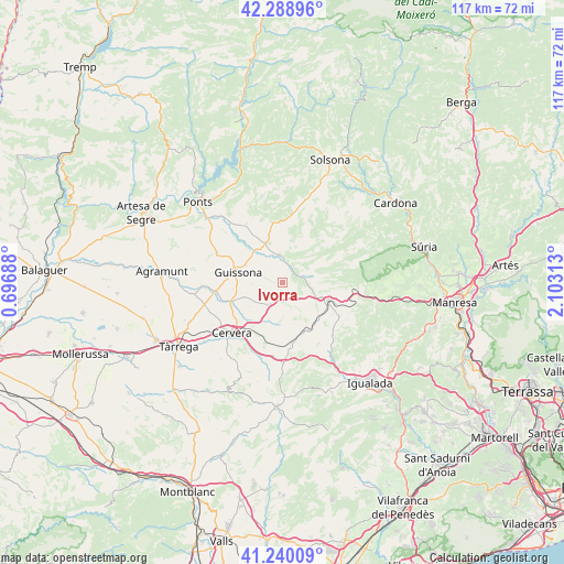
Ivorra GPS coordinates[2]
41° 46' 0.012" North, 1° 24' 0" East
| Map corner | latitude | longitude |
|---|---|---|
| Upper-left | 42.28896°, | 0.69688° |
| Center: | 41.76667°, | 1.4° |
| Lower-right: | 41.24009°, | 2.10313° |
| Map W x H: | 116.6×116.6 km | = 72.5×72.5mi |
| max Lat: | 43.74134° ⇑32.2% North |
| Ivorra: | 41.76667° |
| min Lat: | ⇓67.8% South 27.64134° |
| min Long | Ivorra | max Long |
| -18.00367° | 1.4° | 4.2899° |
| W 91.5%⇐ | ⇒8.5% E |
Elevation
Elevation of Ivorra is 548 m = 1798 ft, and this is 50 m = 164 ft below average elevation for this country.
| Max E: |
1682 m = 5518 ft | 58.5% |
| Avg. | 598 m = 1962 ft | |
| Ivorra | 548 m = 1798 ft | |
Min E: |
0 m = 0 ft | 41.5% |
See also: Spain elevation on elevation.city.
Geographical zone
Ivorra is located in North temperate zone (between Tropic of Cancer and the Arctic Circle). Distance of this Northern Tropic circle is 2038.1 km =1266.4 mi to South.| Distance of | km | miles | from Ivorra |
|---|---|---|---|
| North Pole | 5363 | 3332.4 | to North |
| Arctic Circle | 2757.2 | 1713.2 | to North |
| Tropic Cancer | 2038.1 | 1266.4 | to South |
| Equator | 4644 | 2885.6 | to South |


Nearby cities:
15 places around Ivorra: (largest is in red/bold)
• Agramunt
25.2 km =15.7 mi,  275°
275°
• Aguilar de Segarra
19.1 km =11.9 mi,  96°
96°
• Argensola
19.1 km =11.9 mi,  168°
168°
• Calaf
10.2 km =6.3 mi,  111°
111°
• Castellfollit de Riubregós
2.8 km =1.7 mi,  90°
90°
• Cervera
15.1 km =9.4 mi,  224°
224°
• Fonollosa
22.3 km =13.9 mi, 91°
• Jorba
22 km =13.7 mi,  146°
146°
• Ossó de Sió
20 km =12.4 mi,  266°
266°
• Ponts
24.3 km =15.1 mi,  313°
313°
• Pujalt
5.8 km =3.6 mi,  162°
162°
• Rajadell
25.8 km =16 mi, 99°
• Sant Guim de Freixenet
12.4 km =7.7 mi, 172°
• Torà de Riubregós
5.6 km =3.5 mi,  0°
0°
• Tàrrega
25.4 km =15.8 mi,  238°
238°
Sources, notices
• [Note1] Compared only with cities in Spain existing in our database
• [Src1] Map data: © OpenStreetMap contributors (CC-BY-SA)
• [Src2] Other city data from geonames.org with taken over terms of usage.
• [Src3] Geographical zone / Annual Mean Temperature by Robert A. Rohde @ Wikipedia
