Hontangas geodata
Hontangas (Castille and León) is a seat of a third-order administrative division; located in Spain in Europe/Madrid (GMT+2) time zone. With population of 129 people, there are 5591 cities with bigger population in this country. Compared to other cities in Spain, 63% of cities are located further ↓South; 56.7% of cities are located further →East and 73.5% of cities have lower elevation than Hontangas. Note1
Administrative division(s):
- Level 1: Castille and León
- Level 2: Provincia de Burgos
- Level 3: Hontangas


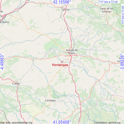
Hontangas GPS coordinates[2]
41° 34' 55.776" North, 3° 47' 43.8" West
| Map corner | latitude | longitude |
|---|---|---|
| Upper-left | 42.10596°, | -4.49863° |
| Center: | 41.58216°, | -3.7955° |
| Lower-right: | 41.05408°, | -3.09238° |
| Map W x H: | 117×117 km | = 72.7×72.7mi |
| max Lat: | 43.74134° ⇑37% North |
| Hontangas: | 41.58216° |
| min Lat: | ⇓63% South 27.64134° |
| min Long | Hontangas | max Long |
| -18.00367° | -3.7955° | 4.2899° |
| W 43.3%⇐ | ⇒56.7% E |
Elevation
Elevation of Hontangas is 839 m = 2753 ft, and this is 241 m = 791 ft above average elevation for this country.
| Max E: |
1682 m = 5518 ft | 26.5% |
| Hontangas | 839 m 2753 ft | |
| Avg. | 598 m = 1962 ft | |
Min E: |
0 m = 0 ft | 73.5% |
See also: Spain elevation on elevation.city.
Geographical zone
Hontangas is located in North temperate zone (between Tropic of Cancer and the Arctic Circle). Distance of this Northern Tropic circle is 2017.6 km =1253.7 mi to South.| Distance of | km | miles | from Hontangas |
|---|---|---|---|
| North Pole | 5383.6 | 3345.2 | to North |
| Arctic Circle | 2777.7 | 1726 | to North |
| Tropic Cancer | 2017.6 | 1253.7 | to South |
| Equator | 4623.5 | 2872.9 | to South |


Nearby cities:
15 places around Hontangas: (largest is in red/bold)
• Adrada de Haza
2.7 km =1.7 mi,  300°
300°
• Campillo de Aranda
6.3 km =3.9 mi,  60°
60°
• Castrillo de la Vega
7.8 km =4.8 mi,  8°
8°
• Fuentecén
8 km =5 mi,  310°
310°
• Fuentelisendo
9.9 km =6.2 mi, 297°
• Fuentemolinos
5.2 km =3.2 mi, 298°
• Fuentenebro
6.9 km =4.3 mi,  150°
150°
• Fuentespina
10.7 km =6.6 mi, 59°
• Haza
4.2 km =2.6 mi,  335°
335°
• Honrubia de la Cuesta
11 km =6.8 mi,  136°
136°
• Hoyales de Roa
10.2 km =6.3 mi,  327°
327°
• Milagros
8.1 km =5 mi,  95°
95°
• Moradillo de Roa
3.4 km =2.1 mi,  173°
173°
• Pardilla
7.8 km =4.8 mi,  115°
115°
• Torregalindo
3.6 km =2.2 mi,  88°
88°
Sources, notices
• [Note1] Compared only with cities in Spain existing in our database
• [Src1] Map data: © OpenStreetMap contributors (CC-BY-SA)
• [Src2] Other city data from geonames.org with taken over terms of usage.
• [Src3] Geographical zone / Annual Mean Temperature by Robert A. Rohde @ Wikipedia
