Honrubia de la Cuesta geodata
Honrubia de la Cuesta (Castille and León) is a seat of a third-order administrative division; located in Spain in Europe/Madrid (GMT+2) time zone. With population of 121 people, there are 5686 cities with bigger population in this country. Compared to other cities in Spain, 61.1% of cities are located further ↓South; 55.5% of cities are located further →East and 88.1% of cities have lower elevation than Honrubia de la Cuesta. Note1
Administrative division(s):
- Level 1: Castille and León
- Level 2: Provincia de Segovia
- Level 3: Honrubia de la Cuesta
Current local time in Honrubia de la Cuesta:
10:40 PM, ThursdayDifference from your time zone: hours


Honrubia de la Cuesta GPS coordinates[2]
41° 30' 35.928" North, 3° 42' 16.308" West
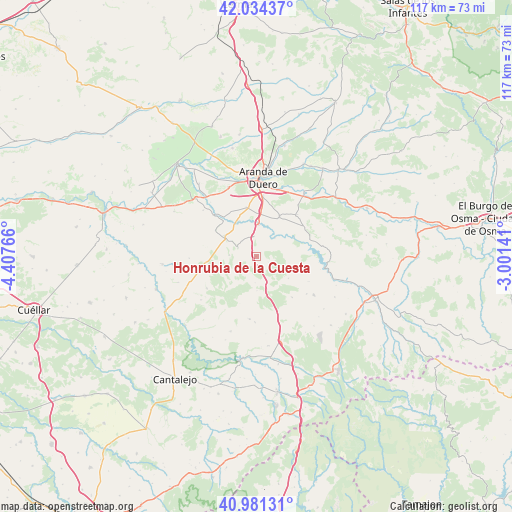
| Map corner | latitude | longitude |
|---|---|---|
| Upper-left | 42.03437°, | -4.40766° |
| Center: | 41.50998°, | -3.70453° |
| Lower-right: | 40.98131°, | -3.00141° |
| Map W x H: | 117.1×117.1 km | = 72.8×72.8mi |
| max Lat: | 43.74134° ⇑38.9% North |
| Honrubia de la Cuesta: | 41.50998° |
| min Lat: | ⇓61.1% South 27.64134° |
| min Long | Honrubia de la | max Long |
| -18.00367° | -3.70453° | 4.2899° |
| W 44.5%⇐ | ⇒55.5% E |
Elevation
Elevation of Honrubia de la Cuesta is 999 m = 3278 ft, and this is 401 m = 1316 ft above average elevation for this country.
| Max E: |
1682 m = 5518 ft | 11.9% |
| Honrubia de la Cuesta | 999 m 3278 ft | |
| Avg. | 598 m = 1962 ft | |
Min E: |
0 m = 0 ft | 88.1% |
See also: Spain elevation on elevation.city.
Geographical zone
Honrubia de la Cuesta is located in North temperate zone (between Tropic of Cancer and the Arctic Circle). Distance of this Northern Tropic circle is 2009.6 km =1248.7 mi to South.| Distance of | km | miles | from Honrubia de la Cuesta |
|---|---|---|---|
| North Pole | 5391.6 | 3350.2 | to North |
| Arctic Circle | 2785.7 | 1731 | to North |
| Tropic Cancer | 2009.6 | 1248.7 | to South |
| Equator | 4615.5 | 2867.9 | to South |


Nearby cities:
15 places around Honrubia de la Cuesta: (largest is in red/bold)
• Campillo de Aranda
11.3 km =7 mi,  349°
349°
• Cedillo de la Torre
12.5 km =7.8 mi,  139°
139°
• Fuentelcésped
10.5 km =6.5 mi,  30°
30°
• Fuentenebro
4.7 km =2.9 mi,  296°
296°
• Hontangas
11 km =6.8 mi,  316°
316°
• Milagros
7.2 km =4.5 mi,  3°
3°
• Montejo de la Vega de la Serrezuela
6.1 km =3.8 mi,  43°
43°
• Moradillo de Roa
8.6 km =5.3 mi, 302°
• Navares de las Cuevas
11.3 km =7 mi,  199°
199°
• Pardilla
4.7 km =2.9 mi, 353°
• Pradales
6.1 km =3.8 mi,  182°
182°
• Santa Cruz de la Salceda
13.3 km =8.3 mi, 44°
• Torregalindo
9 km =5.6 mi,  333°
333°
• Valdevacas de Montejo
5.9 km =3.7 mi,  78°
78°
• Villaverde de Montejo
4.4 km =2.7 mi,  71°
71°
Sources, notices
• [Note1] Compared only with cities in Spain existing in our database
• [Src1] Map data: © OpenStreetMap contributors (CC-BY-SA)
• [Src2] Other city data from geonames.org with taken over terms of usage.
• [Src3] Geographical zone / Annual Mean Temperature by Robert A. Rohde @ Wikipedia
