Milagros geodata
Milagros (Castille and León) is a seat of a third-order administrative division; located in Spain in Europe/Madrid (GMT+2) time zone. With population of 494 people, there are 3906 cities with bigger population in this country. Compared to other cities in Spain, 62.8% of cities are located further ↓South; 55.3% of cities are located further →East and 74.9% of cities have lower elevation than Milagros. Note1
Administrative division(s):
- Level 1: Castille and León
- Level 2: Provincia de Burgos
- Level 3: Milagros


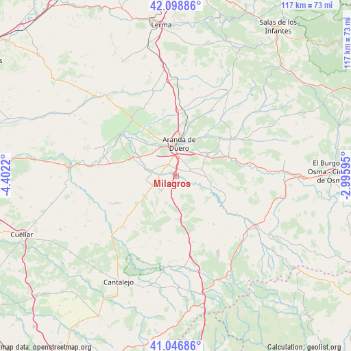
Milagros GPS coordinates[2]
41° 34' 30" North, 3° 41' 56.652" West
| Map corner | latitude | longitude |
|---|---|---|
| Upper-left | 42.09886°, | -4.4022° |
| Center: | 41.575°, | -3.69907° |
| Lower-right: | 41.04686°, | -2.99595° |
| Map W x H: | 117×117 km | = 72.7×72.7mi |
| max Lat: | 43.74134° ⇑37.2% North |
| Milagros: | 41.575° |
| min Lat: | ⇓62.8% South 27.64134° |
| min Long | Milagros | max Long |
| -18.00367° | -3.69907° | 4.2899° |
| W 44.7%⇐ | ⇒55.3% E |
Elevation
Elevation of Milagros is 850 m = 2789 ft, and this is 252 m = 827 ft above average elevation for this country.
| Max E: |
1682 m = 5518 ft | 25.1% |
| Milagros | 850 m 2789 ft | |
| Avg. | 598 m = 1962 ft | |
Min E: |
0 m = 0 ft | 74.9% |
See also: Spain elevation on elevation.city.
Geographical zone
Milagros is located in North temperate zone (between Tropic of Cancer and the Arctic Circle). Distance of this Northern Tropic circle is 2016.8 km =1253.2 mi to South.| Distance of | km | miles | from Milagros |
|---|---|---|---|
| North Pole | 5384.4 | 3345.7 | to North |
| Arctic Circle | 2778.5 | 1726.5 | to North |
| Tropic Cancer | 2016.8 | 1253.2 | to South |
| Equator | 4622.7 | 2872.4 | to South |


Nearby cities:
15 places around Milagros: (largest is in red/bold)
• Aranda de Duero
10.6 km =6.6 mi,  4°
4°
• Campillo de Aranda
4.7 km =2.9 mi,  326°
326°
• Fresnillo de las Dueñas
9.2 km =5.7 mi,  29°
29°
• Fuentelcésped
5.2 km =3.2 mi,  69°
69°
• Fuentenebro
6.9 km =4.3 mi,  221°
221°
• Fuentespina
6.3 km =3.9 mi,  10°
10°
• Honrubia de la Cuesta
7.2 km =4.5 mi,  183°
183°
• Hontangas
8.1 km =5 mi,  275°
275°
• Montejo de la Vega de la Serrezuela
4.6 km =2.9 mi,  126°
126°
• Moradillo de Roa
8.1 km =5 mi,  251°
251°
• Pardilla
2.8 km =1.7 mi,  200°
200°
• Santa Cruz de la Salceda
9.1 km =5.7 mi,  75°
75°
• Torregalindo
4.5 km =2.8 mi, 281°
• Valdevacas de Montejo
8 km =5 mi,  138°
138°
• Villaverde de Montejo
6.9 km =4.3 mi,  147°
147°
Sources, notices
• [Note1] Compared only with cities in Spain existing in our database
• [Src1] Map data: © OpenStreetMap contributors (CC-BY-SA)
• [Src2] Other city data from geonames.org with taken over terms of usage.
• [Src3] Geographical zone / Annual Mean Temperature by Robert A. Rohde @ Wikipedia
