Fontcoberta geodata
Fontcoberta (Catalonia) is a seat of a third-order administrative division; located in Spain in Europe/Madrid (GMT+2) time zone. In our database, there are 6762 cities with bigger population. Compared to other cities in Spain, 77.4% of cities are located further ↓South; 97.6% of cities are located further ←West and 84.7% of cities have higher elevation than Fontcoberta. Note1


Fontcoberta GPS coordinates[2]
42° 7' 59.988" North, 2° 48' 0" East
| Map corner | latitude | longitude |
|---|---|---|
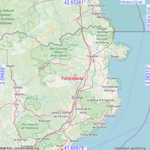
| Upper-left | 42.65261°, | 2.09688° |
| Center: | 42.13333°, | 2.8° |
| Lower-right: | 41.60976°, | 3.50313° |
| Map W x H: | 116×116 km | = 72.1×72.1mi |
| max Lat: | 43.74134° ⇑22.6% North |
| Fontcoberta: | 42.13333° |
| min Lat: | ⇓77.4% South 27.64134° |
| min Long | Fontcoberta | max Long |
| -18.00367° | 2.8° | 4.2899° |
| W 97.6%⇐ | ⇒2.4% E |
Elevation
Elevation of Fontcoberta is 145 m = 476 ft, and this is 453 m = 1486 ft below average elevation for this country.
| Max E: |
1682 m = 5518 ft | 84.7% |
| Avg. | 598 m = 1962 ft | |
| Fontcoberta | 145 m = 476 ft | |
Min E: |
0 m = 0 ft | 15.3% |
See also: Spain elevation on elevation.city.
Geographical zone
Fontcoberta is located in North temperate zone (between Tropic of Cancer and the Arctic Circle). Distance of this Northern Tropic circle is 2078.9 km =1291.8 mi to South.| Distance of | km | miles | from Fontcoberta |
|---|---|---|---|
| North Pole | 5322.3 | 3307.1 | to North |
| Arctic Circle | 2716.4 | 1687.9 | to North |
| Tropic Cancer | 2078.9 | 1291.8 | to South |
| Equator | 4684.8 | 2911 | to South |


Nearby cities:
15 places around Fontcoberta: (largest is in red/bold)
• Banyoles
3.3 km =2.1 mi,  236°
236°
• Besalú
11 km =6.8 mi,  311°
311°
• Bàscara
9.6 km =6 mi,  71°
71°
• Cabanelles
10.9 km =6.8 mi,  8°
8°
• Camós
5.9 km =3.7 mi,  211°
211°
• Cervià de Ter
11.6 km =7.2 mi,  129°
129°
• Cornellà del Terri
5.7 km =3.5 mi,  166°
166°
• Crespià
5.6 km =3.5 mi,  0°
0°
• Esponellà
3.7 km =2.3 mi, 0°
• Navata
11.2 km =7 mi,  26°
26°
• Palol de Revardit
7.4 km =4.6 mi,  180°
180°
• Pontós
11.3 km =7 mi,  58°
58°
• Porqueres
5.2 km =3.2 mi,  249°
249°
• Sant Miquel de Campmajor
9.6 km =6 mi,  270°
270°
• Vilademuls
7.3 km =4.5 mi,  85°
85°
Sources, notices
• [Note1] Compared only with cities in Spain existing in our database
• [Src1] Map data: © OpenStreetMap contributors (CC-BY-SA)
• [Src2] Other city data from geonames.org with taken over terms of usage.
• [Src3] Geographical zone / Annual Mean Temperature by Robert A. Rohde @ Wikipedia
