Fabara geodata
Fabara (Aragon) is a seat of a third-order administrative division; located in Spain in Europe/Madrid (GMT+2) time zone. With population of 1,188 people, there are 2730 cities with bigger population in this country. Compared to other cities in Spain, 52.7% of cities are located further ↓South; 87.8% of cities are located further ←West and 78.1% of cities have higher elevation than Fabara. Note1


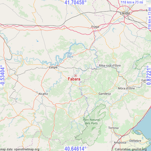
Fabara GPS coordinates[2]
41° 10' 39" North, 0° 10' 8.688" East
| Map corner | latitude | longitude |
|---|---|---|
| Upper-left | 41.70458°, | -0.53404° |
| Center: | 41.1775°, | 0.16908° |
| Lower-right: | 40.64614°, | 0.87221° |
| Map W x H: | 117.7×117.7 km | = 73.1×73.1mi |
| max Lat: | 43.74134° ⇑47.3% North |
| Fabara: | 41.1775° |
| min Lat: | ⇓52.7% South 27.64134° |
| min Long | Fabara | max Long |
| -18.00367° | 0.16908° | 4.2899° |
| W 87.8%⇐ | ⇒12.2% E |
Elevation
Elevation of Fabara is 255 m = 837 ft, and this is 343 m = 1125 ft below average elevation for this country.
| Max E: |
1682 m = 5518 ft | 78.1% |
| Avg. | 598 m = 1962 ft | |
| Fabara | 255 m = 837 ft | |
Min E: |
0 m = 0 ft | 21.9% |
See also: Spain elevation on elevation.city.
Geographical zone
Fabara is located in North temperate zone (between Tropic of Cancer and the Arctic Circle). Distance of this Northern Tropic circle is 1972.6 km =1225.7 mi to South.| Distance of | km | miles | from Fabara |
|---|---|---|---|
| North Pole | 5428.6 | 3373.2 | to North |
| Arctic Circle | 2822.7 | 1753.9 | to North |
| Tropic Cancer | 1972.6 | 1225.7 | to South |
| Equator | 4578.5 | 2844.9 | to South |


Nearby cities:
15 places around Fabara: (largest is in red/bold)
• Arenys de Lledó / Arens de Lledó
22.3 km =13.9 mi,  157°
157°
• Batea
15.1 km =9.4 mi,  127°
127°
• Bot
26 km =16.2 mi,  136°
136°
• Calaceite
18 km =11.2 mi,  174°
174°
• Caseres
17.4 km =10.8 mi, 157°
• Caspe
18.5 km =11.5 mi,  289°
289°
• Fayón
15.3 km =9.5 mi,  63°
63°
• Maella
6.6 km =4.1 mi,  202°
202°
• Mazaleón
15.2 km =9.4 mi, 201°
• Mequinensa / Mequinenza
24.3 km =15.1 mi,  27°
27°
• Nonaspe
7.4 km =4.6 mi, 62°
• Valdeltormo
22.3 km =13.9 mi, 198°
• Vilalba dels Arcs
21.8 km =13.5 mi,  108°
108°
• la Fatarella
26.3 km =16.3 mi,  92°
92°
• la Pobla de Massaluca
15.2 km =9.4 mi, 87°
Sources, notices
• [Note1] Compared only with cities in Spain existing in our database
• [Src1] Map data: © OpenStreetMap contributors (CC-BY-SA)
• [Src2] Other city data from geonames.org with taken over terms of usage.
• [Src3] Geographical zone / Annual Mean Temperature by Robert A. Rohde @ Wikipedia
