Pelayos de la Presa geodata
Pelayos de la Presa (Madrid) is a seat of a third-order administrative division; located in Spain in Europe/Madrid (GMT+2) time zone. With population of 2,197 people, there are 2050 cities with bigger population in this country. Compared to other cities in Spain, 64.7% of cities are located further ↑North; 64.2% of cities are located further →East and 57.2% of cities have higher elevation than Pelayos de la Presa. Note1
Administrative division(s):
- Level 1: Madrid
- Level 2: Provincia de Madrid
- Level 3: Pelayos de la Presa


Pelayos de la Presa GPS coordinates[2]
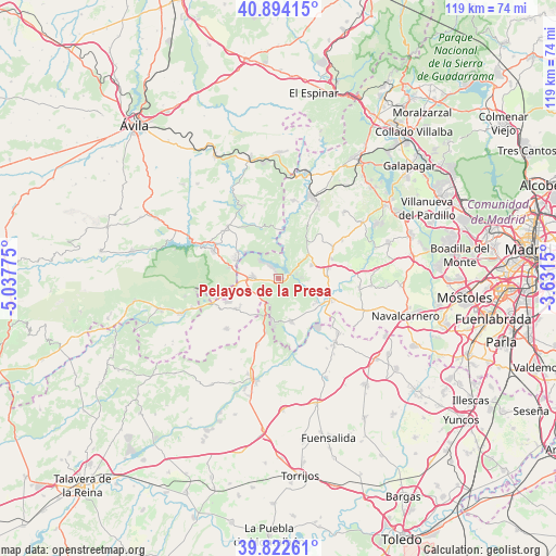
40° 21' 37.836" North, 4° 20' 4.632" West
| Map corner | latitude | longitude |
|---|---|---|
| Upper-left | 40.89415°, | -5.03775° |
| Center: | 40.36051°, | -4.33462° |
| Lower-right: | 39.82261°, | -3.6315° |
| Map W x H: | 119.1×119.1 km | = 74×74mi |
| max Lat: | 43.74134° ⇑64.7% North |
| Pelayos de la Presa: | 40.36051° |
| min Lat: | ⇓35.3% South 27.64134° |
| min Long | Pelayos de la P | max Long |
| -18.00367° | -4.33462° | 4.2899° |
| W 35.8%⇐ | ⇒64.2% E |
Elevation
Elevation of Pelayos de la Presa is 560 m = 1837 ft, and this is 38 m = 125 ft below average elevation for this country.
| Max E: |
1682 m = 5518 ft | 57.2% |
| Avg. | 598 m = 1962 ft | |
| Pelayos de la Presa | 560 m = 1837 ft | |
Min E: |
0 m = 0 ft | 42.8% |
See also: Spain elevation on elevation.city.
Geographical zone
Pelayos de la Presa is located in North temperate zone (between Tropic of Cancer and the Arctic Circle). Distance of this Northern Tropic circle is 1881.7 km =1169.2 mi to South.| Distance of | km | miles | from Pelayos de la Presa |
|---|---|---|---|
| North Pole | 5519.4 | 3429.6 | to North |
| Arctic Circle | 2913.5 | 1810.4 | to North |
| Tropic Cancer | 1881.7 | 1169.2 | to South |
| Equator | 4487.7 | 2788.5 | to South |


Nearby cities:
15 places around Pelayos de la Presa: (largest is in red/bold)
• Aldea del Fresno
11.9 km =7.4 mi,  110°
110°
• Almorox
14.8 km =9.2 mi,  198°
198°
• Cadalso de los Vidrios
10.7 km =6.6 mi,  231°
231°
• Cebreros
15.5 km =9.6 mi,  314°
314°
• Cenicientos
15.5 km =9.6 mi, 226°
• Chapinería
10.7 km =6.6 mi,  79°
79°
• Colmenar del Arroyo
13.2 km =8.2 mi,  60°
60°
• El Hoyo de Pinares
17.3 km =10.7 mi,  334°
334°
• El Tiemblo
15.4 km =9.6 mi,  293°
293°
• Navahondilla
14.3 km =8.9 mi,  253°
253°
• Navas del Rey
7.6 km =4.7 mi,  68°
68°
• Rozas de Puerto Real
13.5 km =8.4 mi, 248°
• San Martín de Valdeiglesias
5.4 km =3.4 mi,  271°
271°
• Valdemaqueda
17.1 km =10.6 mi,  10°
10°
• Villa del Prado
9.4 km =5.8 mi,  164°
164°
Sources, notices
• [Note1] Compared only with cities in Spain existing in our database
• [Src1] Map data: © OpenStreetMap contributors (CC-BY-SA)
• [Src2] Other city data from geonames.org with taken over terms of usage.
• [Src3] Geographical zone / Annual Mean Temperature by Robert A. Rohde @ Wikipedia
