Figaró geodata
Figaró (Catalonia) is a populated place; located in Spain in Europe/Madrid (GMT+2) time zone. With population of 1,020 people, there are 2913 cities with bigger population in this country. Compared to other cities in Spain, 66.6% of cities are located further ↓South; 95.7% of cities are located further ←West and 73.3% of cities have higher elevation than Figaró. Note1
Administrative division(s):
- Level 1: Catalonia
- Level 2: Província de Barcelona
- Level 3: Figaró-Montmany


Figaró GPS coordinates[2]
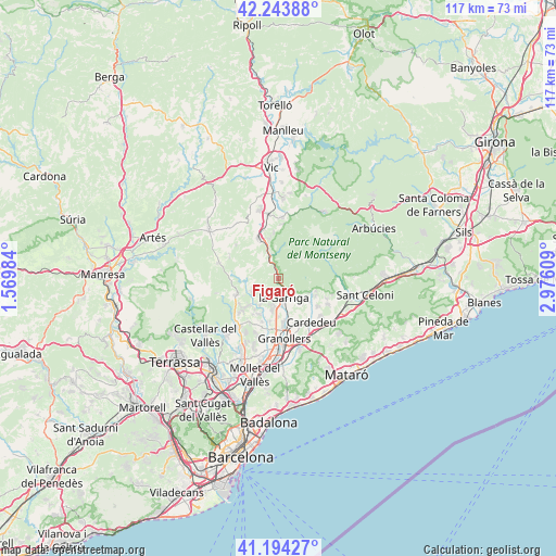
41° 43' 16.392" North, 2° 16' 22.692" East
| Map corner | latitude | longitude |
|---|---|---|
| Upper-left | 42.24388°, | 1.56984° |
| Center: | 41.72122°, | 2.27297° |
| Lower-right: | 41.19427°, | 2.97609° |
| Map W x H: | 116.7×116.7 km | = 72.5×72.5mi |
| max Lat: | 43.74134° ⇑33.4% North |
| Figaró: | 41.72122° |
| min Lat: | ⇓66.6% South 27.64134° |
| min Long | Figaró | max Long |
| -18.00367° | 2.27297° | 4.2899° |
| W 95.7%⇐ | ⇒4.3% E |
Elevation
Elevation of Figaró is 326 m = 1070 ft, and this is 272 m = 892 ft below average elevation for this country.
| Max E: |
1682 m = 5518 ft | 73.3% |
| Avg. | 598 m = 1962 ft | |
| Figaró | 326 m = 1070 ft | |
Min E: |
0 m = 0 ft | 26.7% |
See also: Spain elevation on elevation.city.
Geographical zone
Figaró is located in North temperate zone (between Tropic of Cancer and the Arctic Circle). Distance of this Northern Tropic circle is 2033 km =1263.2 mi to South.| Distance of | km | miles | from Figaró |
|---|---|---|---|
| North Pole | 5368.1 | 3335.6 | to North |
| Arctic Circle | 2762.2 | 1716.4 | to North |
| Tropic Cancer | 2033 | 1263.2 | to South |
| Equator | 4639 | 2882.5 | to South |


Nearby cities:
15 places around Figaró: (largest is in red/bold)
• Aiguafreda
5.5 km =3.4 mi,  340°
340°
• Bigues i Riells
5.3 km =3.3 mi,  217°
217°
• Cardedeu
11.5 km =7.1 mi,  142°
142°
• Castellcir
10.3 km =6.4 mi,  295°
295°
• Centelles
9.6 km =6 mi,  332°
332°
• Cànoves i Samalús
7.7 km =4.8 mi,  123°
123°
• L'Ametlla del Vallès
6.1 km =3.8 mi,  184°
184°
• Les Franqueses del Vallès
11.5 km =7.1 mi,  169°
169°
• Sant Feliu de Codines
9.1 km =5.7 mi,  255°
255°
• Sant Martí de Centelles
7.5 km =4.7 mi,  311°
311°
• Sant Pere de Vilamajor
10.1 km =6.3 mi,  114°
114°
• Sant Quirze Safaja
10.3 km =6.4 mi,  277°
277°
• Santa Eulàlia de Ronçana
8.6 km =5.3 mi,  202°
202°
• Tagamanent
1.9 km =1.2 mi,  345°
345°
• la Garriga
4.3 km =2.7 mi, 168°
Sources, notices
• [Note1] Compared only with cities in Spain existing in our database
• [Src1] Map data: © OpenStreetMap contributors (CC-BY-SA)
• [Src2] Other city data from geonames.org with taken over terms of usage.
• [Src3] Geographical zone / Annual Mean Temperature by Robert A. Rohde @ Wikipedia
