Corcos geodata
Corcos (Castille and León) is a seat of a third-order administrative division; located in Spain in Europe/Madrid (GMT+2) time zone. With population of 264 people, there are 4669 cities with bigger population in this country. Compared to other cities in Spain, 68.7% of cities are located further ↓South; 68.6% of cities are located further →East and 67% of cities have lower elevation than Corcos. Note1
Administrative division(s):
- Level 1: Castille and León
- Level 2: Provincia de Valladolid
- Level 3: Corcos


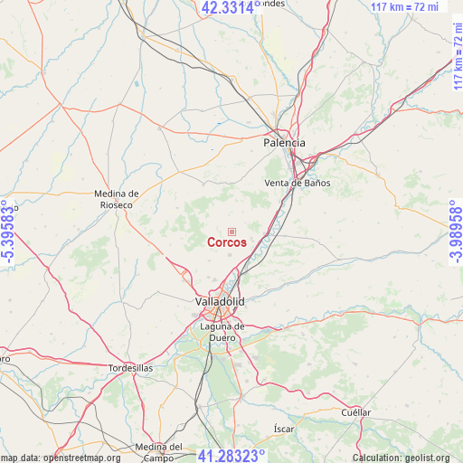
Corcos GPS coordinates[2]
41° 48' 34.056" North, 4° 41' 33.72" West
| Map corner | latitude | longitude |
|---|---|---|
| Upper-left | 42.3314°, | -5.39583° |
| Center: | 41.80946°, | -4.6927° |
| Lower-right: | 41.28323°, | -3.98958° |
| Map W x H: | 116.5×116.5 km | = 72.4×72.4mi |
| max Lat: | 43.74134° ⇑31.3% North |
| Corcos: | 41.80946° |
| min Lat: | ⇓68.7% South 27.64134° |
| min Long | Corcos | max Long |
| -18.00367° | -4.6927° | 4.2899° |
| W 31.4%⇐ | ⇒68.6% E |
Elevation
Elevation of Corcos is 792 m = 2598 ft, and this is 194 m = 636 ft above average elevation for this country.
| Max E: |
1682 m = 5518 ft | 33% |
| Corcos | 792 m 2598 ft | |
| Avg. | 598 m = 1962 ft | |
Min E: |
0 m = 0 ft | 67% |
See also: Spain elevation on elevation.city.
Geographical zone
Corcos is located in North temperate zone (between Tropic of Cancer and the Arctic Circle). Distance of this Northern Tropic circle is 2042.9 km =1269.4 mi to South.| Distance of | km | miles | from Corcos |
|---|---|---|---|
| North Pole | 5358.3 | 3329.5 | to North |
| Arctic Circle | 2752.4 | 1710.3 | to North |
| Tropic Cancer | 2042.9 | 1269.4 | to South |
| Equator | 4648.8 | 2888.6 | to South |


Nearby cities:
15 places around Corcos: (largest is in red/bold)
• Ampudia
13.9 km =8.6 mi,  328°
328°
• Cabezón
9.3 km =5.8 mi,  154°
154°
• Cigales
5.8 km =3.6 mi,  184°
184°
• Cubillas de Santa Marta
7 km =4.3 mi,  67°
67°
• Dueñas
14.2 km =8.8 mi,  58°
58°
• Fuensaldaña
13 km =8.1 mi,  207°
207°
• Mucientes
9.4 km =5.8 mi,  217°
217°
• Quintanilla de Trigueros
5.7 km =3.5 mi,  28°
28°
• Rayaces
12.6 km =7.8 mi,  351°
351°
• San Martín de Valvení
12.1 km =7.5 mi,  120°
120°
• Santa Cecilia del Alcor
14 km =8.7 mi,  12°
12°
• Santovenia de Pisuerga
12.8 km =8 mi, 179°
• Trigueros del Valle
4.1 km =2.5 mi, 55°
• Valoria la Buena
13.5 km =8.4 mi,  94°
94°
• Villalba de los Alcores
15.2 km =9.4 mi,  293°
293°
Sources, notices
• [Note1] Compared only with cities in Spain existing in our database
• [Src1] Map data: © OpenStreetMap contributors (CC-BY-SA)
• [Src2] Other city data from geonames.org with taken over terms of usage.
• [Src3] Geographical zone / Annual Mean Temperature by Robert A. Rohde @ Wikipedia
