Fuensaldaña geodata
Fuensaldaña (Castille and León) is a seat of a third-order administrative division; located in Spain in Europe/Madrid (GMT+2) time zone. With population of 1,177 people, there are 2743 cities with bigger population in this country. Compared to other cities in Spain, 66.2% of cities are located further ↓South; 69.3% of cities are located further →East and 60.7% of cities have lower elevation than Fuensaldaña. Note1
Administrative division(s):
- Level 1: Castille and León
- Level 2: Provincia de Valladolid
- Level 3: Fuensaldaña


Fuensaldaña GPS coordinates[2]
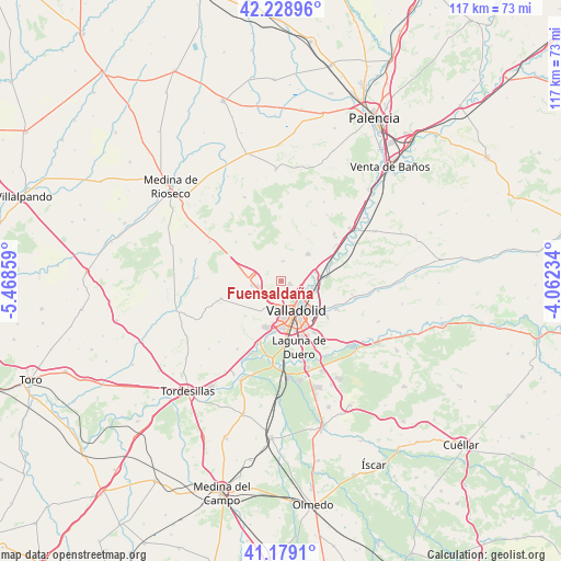
41° 42' 22.212" North, 4° 45' 55.692" West
| Map corner | latitude | longitude |
|---|---|---|
| Upper-left | 42.22896°, | -5.46859° |
| Center: | 41.70617°, | -4.76547° |
| Lower-right: | 41.1791°, | -4.06234° |
| Map W x H: | 116.7×116.7 km | = 72.5×72.5mi |
| max Lat: | 43.74134° ⇑33.8% North |
| Fuensaldaña: | 41.70617° |
| min Lat: | ⇓66.2% South 27.64134° |
| min Long | Fuensaldaña | max Long |
| -18.00367° | -4.76547° | 4.2899° |
| W 30.7%⇐ | ⇒69.3% E |
Elevation
Elevation of Fuensaldaña is 749 m = 2457 ft, and this is 151 m = 495 ft above average elevation for this country.
| Max E: |
1682 m = 5518 ft | 39.3% |
| Fuensaldaña | 749 m 2457 ft | |
| Avg. | 598 m = 1962 ft | |
Min E: |
0 m = 0 ft | 60.7% |
See also: Spain elevation on elevation.city.
Geographical zone
Fuensaldaña is located in North temperate zone (between Tropic of Cancer and the Arctic Circle). Distance of this Northern Tropic circle is 2031.4 km =1262.3 mi to South.| Distance of | km | miles | from Fuensaldaña |
|---|---|---|---|
| North Pole | 5369.8 | 3336.6 | to North |
| Arctic Circle | 2763.9 | 1717.4 | to North |
| Tropic Cancer | 2031.4 | 1262.3 | to South |
| Equator | 4637.3 | 2881.5 | to South |


Nearby cities:
15 places around Fuensaldaña: (largest is in red/bold)
• Arroyo de la Encomienda
11.1 km =6.9 mi,  193°
193°
• Cabezón
10.4 km =6.5 mi,  72°
72°
• Castronuevo de Esgueva
14.9 km =9.3 mi,  100°
100°
• Cigales
8 km =5 mi,  44°
44°
• Ciguñuela
10.5 km =6.5 mi,  226°
226°
• Cistérniga
12.2 km =7.6 mi,  147°
147°
• Corcos
13 km =8.1 mi,  27°
27°
• Laguna de Duero
14.3 km =8.9 mi,  165°
165°
• Mucientes
4.1 km =2.5 mi,  4°
4°
• Santovenia de Pisuerga
6.4 km =4 mi, 101°
• Simancas
13.8 km =8.6 mi,  202°
202°
• Valladolid
6.6 km =4.1 mi, 148°
• Villanubla
6.4 km =4 mi,  262°
262°
• Wamba
13.1 km =8.1 mi,  254°
254°
• Zaratán
5.4 km =3.4 mi, 196°
Sources, notices
• [Note1] Compared only with cities in Spain existing in our database
• [Src1] Map data: © OpenStreetMap contributors (CC-BY-SA)
• [Src2] Other city data from geonames.org with taken over terms of usage.
• [Src3] Geographical zone / Annual Mean Temperature by Robert A. Rohde @ Wikipedia
