Chamartín geodata
Chamartín (Castille and León) is a seat of a third-order administrative division; located in Spain in Europe/Madrid (GMT+2) time zone. With population of 94 people, there are 6009 cities with bigger population in this country. Compared to other cities in Spain, 58% of cities are located further ↑North; 71.9% of cities are located further →East and 96.7% of cities have lower elevation than Chamartín. Note1
Administrative division(s):
- Level 1: Castille and León
- Level 2: Provincia de Ávila
- Level 3: Chamartín


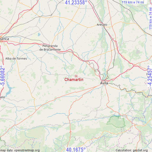
Chamartín GPS coordinates[2]
40° 42' 9.612" North, 4° 57' 27.684" West
| Map corner | latitude | longitude |
|---|---|---|
| Upper-left | 41.23358°, | -5.66082° |
| Center: | 40.70267°, | -4.95769° |
| Lower-right: | 40.1675°, | -4.25457° |
| Map W x H: | 118.5×118.5 km | = 73.6×73.6mi |
| max Lat: | 43.74134° ⇑58% North |
| Chamartín: | 40.70267° |
| min Lat: | ⇓42% South 27.64134° |
| min Long | Chamartín | max Long |
| -18.00367° | -4.95769° | 4.2899° |
| W 28.1%⇐ | ⇒71.9% E |
Elevation
Elevation of Chamartín is 1195 m = 3921 ft, and this is 597 m = 1959 ft above average elevation for this country.
| Max E: |
1682 m = 5518 ft | 3.3% |
| Chamartín | 1195 m 3921 ft | |
| Avg. | 598 m = 1962 ft | |
Min E: |
0 m = 0 ft | 96.7% |
See also: Spain elevation on elevation.city.
Geographical zone
Chamartín is located in North temperate zone (between Tropic of Cancer and the Arctic Circle). Distance of this Northern Tropic circle is 1919.8 km =1192.9 mi to South.| Distance of | km | miles | from Chamartín |
|---|---|---|---|
| North Pole | 5481.3 | 3405.9 | to North |
| Arctic Circle | 2875.5 | 1786.8 | to North |
| Tropic Cancer | 1919.8 | 1192.9 | to South |
| Equator | 4525.7 | 2812.1 | to South |


Nearby cities:
15 places around Chamartín: (largest is in red/bold)
• Brabos
8.6 km =5.3 mi,  10°
10°
• Cillán
2 km =1.2 mi,  282°
282°
• Gallegos de Sobrinos
13.1 km =8.1 mi, 276°
• Herreros de Suso
13.1 km =8.1 mi,  328°
328°
• Manjabálago
10.9 km =6.8 mi,  247°
247°
• Muñico
5.9 km =3.7 mi,  274°
274°
• Muñogalindo
12.1 km =7.5 mi,  155°
155°
• Narrillos del Rebollar
4.3 km =2.7 mi,  189°
189°
• Padiernos
13.1 km =8.1 mi,  133°
133°
• Sanchorreja
5.5 km =3.4 mi,  139°
139°
• Santo Tomé de Zabarcos
10.2 km =6.3 mi,  22°
22°
• Sigeres
10.9 km =6.8 mi, 10°
• Valdecasa
6.6 km =4.1 mi,  223°
223°
• Villaflor
9.4 km =5.8 mi,  48°
48°
• Vita
12.8 km =8 mi,  341°
341°
Sources, notices
• [Note1] Compared only with cities in Spain existing in our database
• [Src1] Map data: © OpenStreetMap contributors (CC-BY-SA)
• [Src2] Other city data from geonames.org with taken over terms of usage.
• [Src3] Geographical zone / Annual Mean Temperature by Robert A. Rohde @ Wikipedia
