San Juan del Monte geodata
San Juan del Monte (Castille and León) is a seat of a third-order administrative division; located in Spain in Europe/Madrid (GMT+2) time zone. With population of 168 people, there are 5281 cities with bigger population in this country. Compared to other cities in Spain, 65.7% of cities are located further ↓South; 52.6% of cities are located further →East and 74.1% of cities have lower elevation than San Juan del Monte. Note1
Administrative division(s):
- Level 1: Castille and León
- Level 2: Provincia de Burgos
- Level 3: San Juan del Monte


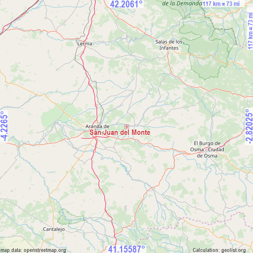
San Juan del Monte GPS coordinates[2]
41° 40' 59.268" North, 3° 31' 24.132" West
| Map corner | latitude | longitude |
|---|---|---|
| Upper-left | 42.2061°, | -4.2265° |
| Center: | 41.68313°, | -3.52337° |
| Lower-right: | 41.15587°, | -2.82025° |
| Map W x H: | 116.8×116.8 km | = 72.6×72.6mi |
| max Lat: | 43.74134° ⇑34.3% North |
| San Juan del Monte: | 41.68313° |
| min Lat: | ⇓65.7% South 27.64134° |
| min Long | San Juan del Mo | max Long |
| -18.00367° | -3.52337° | 4.2899° |
| W 47.4%⇐ | ⇒52.6% E |
Elevation
Elevation of San Juan del Monte is 844 m = 2769 ft, and this is 246 m = 807 ft above average elevation for this country.
| Max E: |
1682 m = 5518 ft | 25.9% |
| San Juan del Monte | 844 m 2769 ft | |
| Avg. | 598 m = 1962 ft | |
Min E: |
0 m = 0 ft | 74.1% |
See also: Spain elevation on elevation.city.
Geographical zone
San Juan del Monte is located in North temperate zone (between Tropic of Cancer and the Arctic Circle). Distance of this Northern Tropic circle is 2028.8 km =1260.6 mi to South.| Distance of | km | miles | from San Juan del Monte |
|---|---|---|---|
| North Pole | 5372.3 | 3338.2 | to North |
| Arctic Circle | 2766.4 | 1719 | to North |
| Tropic Cancer | 2028.8 | 1260.6 | to South |
| Equator | 4634.7 | 2879.9 | to South |


Nearby cities:
15 places around San Juan del Monte: (largest is in red/bold)
• Aranda de Duero
13.8 km =8.6 mi,  264°
264°
• Arandilla
9.9 km =6.2 mi,  52°
52°
• Baños de Valdearados
10 km =6.2 mi,  344°
344°
• Brazacorta
13.5 km =8.4 mi,  73°
73°
• Castillejo de Robledo
14 km =8.7 mi,  170°
170°
• Fresnillo de las Dueñas
10.9 km =6.8 mi,  248°
248°
• Fuentelcésped
14.1 km =8.8 mi,  223°
223°
• Hontoria de Valdearados
6.9 km =4.3 mi,  2°
2°
• Langa de Duero
13.1 km =8.1 mi,  128°
128°
• Peñaranda de Duero
3.8 km =2.4 mi,  80°
80°
• Quemada
4.7 km =2.9 mi,  294°
294°
• Santa Cruz de la Salceda
11.3 km =7 mi,  210°
210°
• Vadocondes
6.4 km =4 mi, 220°
• Villanueva de Gumiel
10.5 km =6.5 mi,  305°
305°
• Zazuar
2.9 km =1.8 mi,  297°
297°
Sources, notices
• [Note1] Compared only with cities in Spain existing in our database
• [Src1] Map data: © OpenStreetMap contributors (CC-BY-SA)
• [Src2] Other city data from geonames.org with taken over terms of usage.
• [Src3] Geographical zone / Annual Mean Temperature by Robert A. Rohde @ Wikipedia
