Castellbisbal geodata
Castellbisbal (Catalonia) is a seat of a third-order administrative division; located in Spain in Europe/Madrid (GMT+2) time zone. With population of 11,977 people, there are 750 cities with bigger population in this country. Compared to other cities in Spain, 60.2% of cities are located further ↓South; 93.4% of cities are located further ←West and 84.2% of cities have higher elevation than Castellbisbal. Note1
Administrative division(s):
- Level 1: Catalonia
- Level 2: Província de Barcelona
- Level 3: Castellbisbal


Castellbisbal GPS coordinates[2]
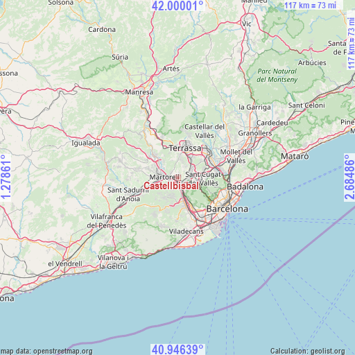
41° 28' 31.224" North, 1° 58' 54.264" East
| Map corner | latitude | longitude |
|---|---|---|
| Upper-left | 42.00001°, | 1.27861° |
| Center: | 41.47534°, | 1.98174° |
| Lower-right: | 40.94639°, | 2.68486° |
| Map W x H: | 117.2×117.2 km | = 72.8×72.8mi |
| max Lat: | 43.74134° ⇑39.8% North |
| Castellbisbal: | 41.47534° |
| min Lat: | ⇓60.2% South 27.64134° |
| min Long | Castellbisbal | max Long |
| -18.00367° | 1.98174° | 4.2899° |
| W 93.4%⇐ | ⇒6.6% E |
Elevation
Elevation of Castellbisbal is 153 m = 502 ft, and this is 445 m = 1460 ft below average elevation for this country.
| Max E: |
1682 m = 5518 ft | 84.2% |
| Avg. | 598 m = 1962 ft | |
| Castellbisbal | 153 m = 502 ft | |
Min E: |
0 m = 0 ft | 15.8% |
See also: Spain elevation on elevation.city.
Geographical zone
Castellbisbal is located in North temperate zone (between Tropic of Cancer and the Arctic Circle). Distance of this Northern Tropic circle is 2005.7 km =1246.3 mi to South.| Distance of | km | miles | from Castellbisbal |
|---|---|---|---|
| North Pole | 5395.4 | 3352.5 | to North |
| Arctic Circle | 2789.5 | 1733.3 | to North |
| Tropic Cancer | 2005.7 | 1246.3 | to South |
| Equator | 4611.6 | 2865.5 | to South |


Nearby cities:
15 places around Castellbisbal: (largest is in red/bold)
• Abrera
8.2 km =5.1 mi,  304°
304°
• Castellví de Rosanes
7.4 km =4.6 mi,  247°
247°
• Cervelló
9 km =5.6 mi,  192°
192°
• Corbera de Llobregat
8.3 km =5.2 mi,  218°
218°
• Martorell
4.3 km =2.7 mi,  268°
268°
• Molins de Rei
7.1 km =4.4 mi,  155°
155°
• Olesa de Montserrat
10.5 km =6.5 mi,  316°
316°
• Pallejà
5.8 km =3.6 mi,  169°
169°
• Rubí
4.7 km =2.9 mi,  66°
66°
• Sant Andreu de la Barca
3.3 km =2.1 mi, 194°
• Sant Cugat del Vallès
8.7 km =5.4 mi,  93°
93°
• Sant Vicenç dels Horts
9.4 km =5.8 mi, 167°
• Terrassa
10.6 km =6.6 mi,  15°
15°
• Ullastrell
6.1 km =3.8 mi,  338°
338°
• Viladecavalls
8.7 km =5.4 mi, 342°
Sources, notices
• [Note1] Compared only with cities in Spain existing in our database
• [Src1] Map data: © OpenStreetMap contributors (CC-BY-SA)
• [Src2] Other city data from geonames.org with taken over terms of usage.
• [Src3] Geographical zone / Annual Mean Temperature by Robert A. Rohde @ Wikipedia
