Castelflorite geodata
Castelflorite (Aragon) is a seat of a third-order administrative division; located in Spain in Europe/Madrid (GMT+2) time zone. With population of 124 people, there are 5647 cities with bigger population in this country. Compared to other cities in Spain, 68.6% of cities are located further ↓South; 86.9% of cities are located further ←West and 74.1% of cities have higher elevation than Castelflorite. Note1


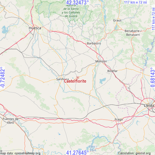
Castelflorite GPS coordinates[2]
41° 48' 9.828" North, 0° 1' 18.084" West
| Map corner | latitude | longitude |
|---|---|---|
| Upper-left | 42.32473°, | -0.72482° |
| Center: | 41.80273°, | -0.02169° |
| Lower-right: | 41.27645°, | 0.68143° |
| Map W x H: | 116.6×116.6 km | = 72.5×72.5mi |
| max Lat: | 43.74134° ⇑31.4% North |
| Castelflorite: | 41.80273° |
| min Lat: | ⇓68.6% South 27.64134° |
| min Long | Castelflorite | max Long |
| -18.00367° | -0.02169° | 4.2899° |
| W 86.9%⇐ | ⇒13.1% E |
Elevation
Elevation of Castelflorite is 311 m = 1020 ft, and this is 287 m = 942 ft below average elevation for this country.
| Max E: |
1682 m = 5518 ft | 74.1% |
| Avg. | 598 m = 1962 ft | |
| Castelflorite | 311 m = 1020 ft | |
Min E: |
0 m = 0 ft | 25.9% |
See also: Spain elevation on elevation.city.
Geographical zone
Castelflorite is located in North temperate zone (between Tropic of Cancer and the Arctic Circle). Distance of this Northern Tropic circle is 2042.1 km =1268.9 mi to South.| Distance of | km | miles | from Castelflorite |
|---|---|---|---|
| North Pole | 5359 | 3329.9 | to North |
| Arctic Circle | 2753.1 | 1710.7 | to North |
| Tropic Cancer | 2042.1 | 1268.9 | to South |
| Equator | 4648 | 2888.1 | to South |


Nearby cities:
15 places around Castelflorite: (largest is in red/bold)
• Albalate de Cinca
16.8 km =10.4 mi,  120°
120°
• Albalatillo
13.1 km =8.1 mi,  235°
235°
• Alcolea de Cinca
14.8 km =9.2 mi,  128°
128°
• Alfántega
14.4 km =8.9 mi,  78°
78°
• Berbegal
17.5 km =10.9 mi,  4°
4°
• Binaced
18.6 km =11.6 mi, 82°
• Capdesaso
14.1 km =8.8 mi,  288°
288°
• Huerto
18.7 km =11.6 mi,  319°
319°
• Ilche
18.4 km =11.4 mi,  20°
20°
• Ontiñena
16.7 km =10.4 mi,  146°
146°
• Peralta de Alcofea
14.8 km =9.2 mi,  345°
345°
• Pueyo de Santa Cruz
16 km =9.9 mi,  67°
67°
• Sariñena
11.4 km =7.1 mi,  263°
263°
• Sena
9.8 km =6.1 mi,  190°
190°
• Villanueva de Sigena
9.7 km =6 mi,  173°
173°
Sources, notices
• [Note1] Compared only with cities in Spain existing in our database
• [Src1] Map data: © OpenStreetMap contributors (CC-BY-SA)
• [Src2] Other city data from geonames.org with taken over terms of usage.
• [Src3] Geographical zone / Annual Mean Temperature by Robert A. Rohde @ Wikipedia
