Binaced geodata
Binaced (Aragon) is a seat of a third-order administrative division; located in Spain in Europe/Madrid (GMT+2) time zone. With population of 1,607 people, there are 2392 cities with bigger population in this country. Compared to other cities in Spain, 69.2% of cities are located further ↓South; 88% of cities are located further ←West and 76.2% of cities have higher elevation than Binaced. Note1


Binaced GPS coordinates[2]
41° 49' 32.304" North, 0° 12' 3.024" East
| Map corner | latitude | longitude |
|---|---|---|
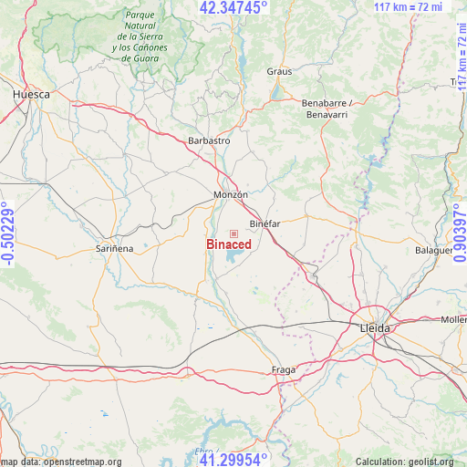
| Upper-left | 42.34745°, | -0.50229° |
| Center: | 41.82564°, | 0.20084° |
| Lower-right: | 41.29954°, | 0.90397° |
| Map W x H: | 116.5×116.5 km | = 72.4×72.4mi |
| max Lat: | 43.74134° ⇑30.8% North |
| Binaced: | 41.82564° |
| min Lat: | ⇓69.2% South 27.64134° |
| min Long | Binaced | max Long |
| -18.00367° | 0.20084° | 4.2899° |
| W 88%⇐ | ⇒12% E |
Elevation
Elevation of Binaced is 283 m = 928 ft, and this is 315 m = 1033 ft below average elevation for this country.
| Max E: |
1682 m = 5518 ft | 76.2% |
| Avg. | 598 m = 1962 ft | |
| Binaced | 283 m = 928 ft | |
Min E: |
0 m = 0 ft | 23.8% |
See also: Spain elevation on elevation.city.
Geographical zone
Binaced is located in North temperate zone (between Tropic of Cancer and the Arctic Circle). Distance of this Northern Tropic circle is 2044.7 km =1270.5 mi to South.| Distance of | km | miles | from Binaced |
|---|---|---|---|
| North Pole | 5356.5 | 3328.4 | to North |
| Arctic Circle | 2750.6 | 1709.1 | to North |
| Tropic Cancer | 2044.7 | 1270.5 | to South |
| Equator | 4650.6 | 2889.7 | to South |


Nearby cities:
15 places around Binaced: (largest is in red/bold)
• Albalate de Cinca
11.9 km =7.4 mi,  199°
199°
• Alcolea de Cinca
13.7 km =8.5 mi,  210°
210°
• Alfántega
4.4 km =2.7 mi,  273°
273°
• Belver de Cinca
14.9 km =9.3 mi,  187°
187°
• Binéfar
8.3 km =5.2 mi,  69°
69°
• Castejón del Puente
15.5 km =9.6 mi,  347°
347°
• Castelflorite
18.6 km =11.6 mi,  262°
262°
• Chalamera
18.1 km =11.2 mi, 190°
• Esplús
6.9 km =4.3 mi,  115°
115°
• Ilche
18.8 km =11.7 mi,  320°
320°
• Monzón
9.5 km =5.9 mi,  356°
356°
• Osso de Cinca
17.7 km =11 mi,  182°
182°
• Pueyo de Santa Cruz
5.1 km =3.2 mi,  314°
314°
• San Esteban de Litera (Sant Esteve de Llitera)
13.7 km =8.5 mi,  49°
49°
• el Torricó / Altorricon
17.8 km =11.1 mi,  98°
98°
Sources, notices
• [Note1] Compared only with cities in Spain existing in our database
• [Src1] Map data: © OpenStreetMap contributors (CC-BY-SA)
• [Src2] Other city data from geonames.org with taken over terms of usage.
• [Src3] Geographical zone / Annual Mean Temperature by Robert A. Rohde @ Wikipedia
