Carabantes geodata
Carabantes (Castille and León) is a seat of a third-order administrative division; located in Spain in Europe/Madrid (GMT+2) time zone. With population of 31 people, there are 6654 cities with bigger population in this country. Compared to other cities in Spain, 62.2% of cities are located further ↓South; 67.6% of cities are located further ←West and 87.4% of cities have lower elevation than Carabantes. Note1
Administrative division(s):
- Level 1: Castille and León
- Level 2: Provincia de Soria
- Level 3: Carabantes


Carabantes GPS coordinates[2]
41° 33' 7.596" North, 1° 59' 53.16" West
| Map corner | latitude | longitude |
|---|---|---|
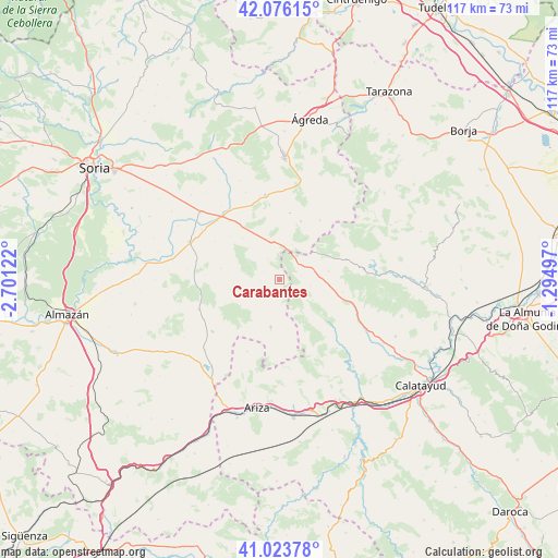
| Upper-left | 42.07615°, | -2.70122° |
| Center: | 41.55211°, | -1.9981° |
| Lower-right: | 41.02378°, | -1.29497° |
| Map W x H: | 117×117 km | = 72.7×72.7mi |
| max Lat: | 43.74134° ⇑37.8% North |
| Carabantes: | 41.55211° |
| min Lat: | ⇓62.2% South 27.64134° |
| min Long | Carabantes | max Long |
| -18.00367° | -1.9981° | 4.2899° |
| W 67.6%⇐ | ⇒32.4% E |
Elevation
Elevation of Carabantes is 987 m = 3238 ft, and this is 389 m = 1276 ft above average elevation for this country.
| Max E: |
1682 m = 5518 ft | 12.6% |
| Carabantes | 987 m 3238 ft | |
| Avg. | 598 m = 1962 ft | |
Min E: |
0 m = 0 ft | 87.4% |
See also: Spain elevation on elevation.city.
Geographical zone
Carabantes is located in North temperate zone (between Tropic of Cancer and the Arctic Circle). Distance of this Northern Tropic circle is 2014.2 km =1251.6 mi to South.| Distance of | km | miles | from Carabantes |
|---|---|---|---|
| North Pole | 5386.9 | 3347.3 | to North |
| Arctic Circle | 2781 | 1728 | to North |
| Tropic Cancer | 2014.2 | 1251.6 | to South |
| Equator | 4620.2 | 2870.9 | to South |


Nearby cities:
15 places around Carabantes: (largest is in red/bold)
• Almazul
12.6 km =7.8 mi,  281°
281°
• Berdejo
4.6 km =2.9 mi,  77°
77°
• Bijuesca
6.6 km =4.1 mi,  100°
100°
• Borobia
15.1 km =9.4 mi,  34°
34°
• Cihuela
16.1 km =10 mi,  180°
180°
• Ciria
7.8 km =4.8 mi,  20°
20°
• Clarés de Ribota
13.6 km =8.5 mi, 100°
• Deza
10 km =6.2 mi,  190°
190°
• Malanquilla
10.4 km =6.5 mi, 79°
• Portillo de Soria
13.8 km =8.6 mi,  311°
311°
• Reznos
5 km =3.1 mi,  330°
330°
• Torrelapaja
5 km =3.1 mi,  49°
49°
• Torrijo de la Cañada
13.5 km =8.4 mi,  130°
130°
• Torrubia de Soria
11.7 km =7.3 mi,  318°
318°
• Villaseca de Arciel
15.8 km =9.8 mi,  300°
300°
Sources, notices
• [Note1] Compared only with cities in Spain existing in our database
• [Src1] Map data: © OpenStreetMap contributors (CC-BY-SA)
• [Src2] Other city data from geonames.org with taken over terms of usage.
• [Src3] Geographical zone / Annual Mean Temperature by Robert A. Rohde @ Wikipedia
