Camaleño geodata
Camaleño (Cantabria) is a seat of a third-order administrative division; located in Spain in Europe/Madrid (GMT+2) time zone. In our database, there are 6762 cities with bigger population. Compared to other cities in Spain, 95.9% of cities are located further ↓South; 68.6% of cities are located further →East and 67.6% of cities have higher elevation than Camaleño. Note1


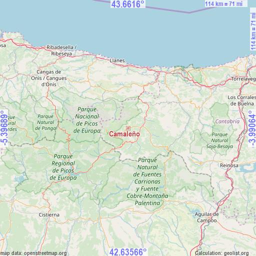
Camaleño GPS coordinates[2]
43° 9' 2.808" North, 4° 41' 37.536" West
| Map corner | latitude | longitude |
|---|---|---|
| Upper-left | 43.6616°, | -5.39689° |
| Center: | 43.15078°, | -4.69376° |
| Lower-right: | 42.63566°, | -3.99064° |
| Map W x H: | 114.1×114.1 km | = 70.9×70.9mi |
| max Lat: | 43.74134° ⇑4.1% North |
| Camaleño: | 43.15078° |
| min Lat: | ⇓95.9% South 27.64134° |
| min Long | Camaleño | max Long |
| -18.00367° | -4.69376° | 4.2899° |
| W 31.4%⇐ | ⇒68.6% E |
Elevation
Elevation of Camaleño is 424 m = 1391 ft, and this is 174 m = 571 ft below average elevation for this country.
| Max E: |
1682 m = 5518 ft | 67.6% |
| Avg. | 598 m = 1962 ft | |
| Camaleño | 424 m = 1391 ft | |
Min E: |
0 m = 0 ft | 32.4% |
See also: Spain elevation on elevation.city.
Geographical zone
Camaleño is located in North temperate zone (between Tropic of Cancer and the Arctic Circle). Distance of this Northern Tropic circle is 2192 km =1362 mi to South.| Distance of | km | miles | from Camaleño |
|---|---|---|---|
| North Pole | 5209.1 | 3236.8 | to North |
| Arctic Circle | 2603.3 | 1617.6 | to North |
| Tropic Cancer | 2192 | 1362 | to South |
| Equator | 4797.9 | 2981.3 | to South |


Nearby cities:
15 places around Camaleño: (largest is in red/bold)
• Amieva
32.6 km =20.3 mi,  288°
288°
• Boca de Huérgano
27.2 km =16.9 mi,  223°
223°
• Burón
32.2 km =20 mi,  244°
244°
• Cabezón de Liébana
9.7 km =6 mi,  100°
100°
• Carreña
22.3 km =13.9 mi,  326°
326°
• Llanes
30.3 km =18.8 mi,  350°
350°
• Onís
30.4 km =18.9 mi,  313°
313°
• Oseja de Sajambre
28 km =17.4 mi,  266°
266°
• Polentinos
27.1 km =16.8 mi,  150°
150°
• Posada de Valdeón
18.4 km =11.4 mi, 270°
• Potes
6 km =3.7 mi,  85°
85°
• Riaño
31.7 km =19.7 mi,  232°
232°
• Ruesga
34.6 km =21.5 mi,  157°
157°
• Tresviso
12.1 km =7.5 mi,  10°
10°
• Triollo
25.2 km =15.7 mi,  177°
177°
Sources, notices
• [Note1] Compared only with cities in Spain existing in our database
• [Src1] Map data: © OpenStreetMap contributors (CC-BY-SA)
• [Src2] Other city data from geonames.org with taken over terms of usage.
• [Src3] Geographical zone / Annual Mean Temperature by Robert A. Rohde @ Wikipedia
