Onís geodata
Onís (Asturias) is a populated place; located in Spain in Europe/Madrid (GMT+2) time zone. With population of 837 people, there are 3150 cities with bigger population in this country. Compared to other cities in Spain, 98.1% of cities are located further ↓South; 72% of cities are located further →East and 79.7% of cities have higher elevation than Onís. Note1


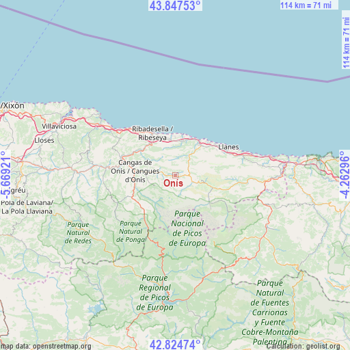
Onís GPS coordinates[2]
43° 20' 17.844" North, 4° 57' 57.888" West
| Map corner | latitude | longitude |
|---|---|---|
| Upper-left | 43.84753°, | -5.66921° |
| Center: | 43.33829°, | -4.96608° |
| Lower-right: | 42.82474°, | -4.26296° |
| Map W x H: | 113.7×113.7 km | = 70.6×70.6mi |
| max Lat: | 43.74134° ⇑1.9% North |
| Onís: | 43.33829° |
| min Lat: | ⇓98.1% South 27.64134° |
| min Long | Onís | max Long |
| -18.00367° | -4.96608° | 4.2899° |
| W 28%⇐ | ⇒72% E |
Elevation
Elevation of Onís is 226 m = 741 ft, and this is 372 m = 1220 ft below average elevation for this country.
| Max E: |
1682 m = 5518 ft | 79.7% |
| Avg. | 598 m = 1962 ft | |
| Onís | 226 m = 741 ft | |
Min E: |
0 m = 0 ft | 20.3% |
See also: Spain elevation on elevation.city.
Geographical zone
Onís is located in North temperate zone (between Tropic of Cancer and the Arctic Circle). Distance of this Northern Tropic circle is 2212.8 km =1375 mi to South.| Distance of | km | miles | from Onís |
|---|---|---|---|
| North Pole | 5188.3 | 3223.9 | to North |
| Arctic Circle | 2582.4 | 1604.6 | to North |
| Tropic Cancer | 2212.8 | 1375 | to South |
| Equator | 4818.8 | 2994.3 | to South |


Nearby cities:
15 places around Onís: (largest is in red/bold)
• Amieva
13.7 km =8.5 mi,  219°
219°
• Camaleño
30.4 km =18.9 mi,  133°
133°
• Campo de Caso
35.2 km =21.9 mi,  240°
240°
• Cangas de Onís
13.3 km =8.3 mi,  276°
276°
• Caravia
22.7 km =14.1 mi,  306°
306°
• Carreña
10 km =6.2 mi,  103°
103°
• Colunga
29.5 km =18.3 mi,  303°
303°
• Llanes
19.3 km =12 mi,  62°
62°
• Oseja de Sajambre
23.2 km =14.4 mi,  194°
194°
• Parres
14.9 km =9.3 mi, 275°
• Piloña
32.4 km =20.1 mi,  272°
272°
• Posada de Valdeón
21.1 km =13.1 mi,  170°
170°
• Potes
34.6 km =21.5 mi, 126°
• Ribadesella
15.6 km =9.7 mi,  331°
331°
• Tresviso
25.8 km =16 mi,  110°
110°
Sources, notices
• [Note1] Compared only with cities in Spain existing in our database
• [Src1] Map data: © OpenStreetMap contributors (CC-BY-SA)
• [Src2] Other city data from geonames.org with taken over terms of usage.
• [Src3] Geographical zone / Annual Mean Temperature by Robert A. Rohde @ Wikipedia
