Cabezuela geodata
Cabezuela (Castille and León) is a seat of a third-order administrative division; located in Spain in Europe/Madrid (GMT+2) time zone. With population of 722 people, there are 3365 cities with bigger population in this country. Compared to other cities in Spain, 54.1% of cities are located further ↓South; 58.7% of cities are located further →East and 85.3% of cities have lower elevation than Cabezuela. Note1
Administrative division(s):
- Level 1: Castille and León
- Level 2: Provincia de Segovia
- Level 3: Cabezuela


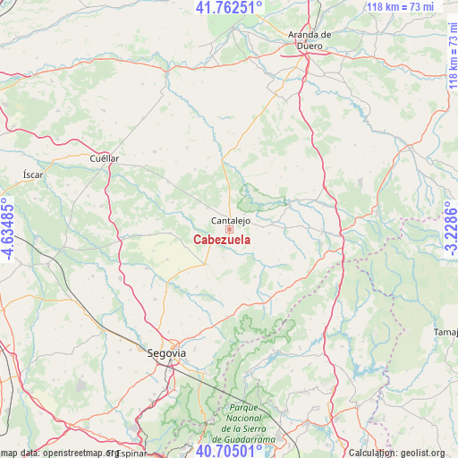
Cabezuela GPS coordinates[2]
41° 14' 9.24" North, 3° 55' 54.228" West
| Map corner | latitude | longitude |
|---|---|---|
| Upper-left | 41.76251°, | -4.63485° |
| Center: | 41.2359°, | -3.93173° |
| Lower-right: | 40.70501°, | -3.2286° |
| Map W x H: | 117.6×117.6 km | = 73.1×73.1mi |
| max Lat: | 43.74134° ⇑45.9% North |
| Cabezuela: | 41.2359° |
| min Lat: | ⇓54.1% South 27.64134° |
| min Long | Cabezuela | max Long |
| -18.00367° | -3.93173° | 4.2899° |
| W 41.3%⇐ | ⇒58.7% E |
Elevation
Elevation of Cabezuela is 954 m = 3130 ft, and this is 356 m = 1168 ft above average elevation for this country.
| Max E: |
1682 m = 5518 ft | 14.7% |
| Cabezuela | 954 m 3130 ft | |
| Avg. | 598 m = 1962 ft | |
Min E: |
0 m = 0 ft | 85.3% |
See also: Spain elevation on elevation.city.
Geographical zone
Cabezuela is located in North temperate zone (between Tropic of Cancer and the Arctic Circle). Distance of this Northern Tropic circle is 1979.1 km =1229.8 mi to South.| Distance of | km | miles | from Cabezuela |
|---|---|---|---|
| North Pole | 5422.1 | 3369.1 | to North |
| Arctic Circle | 2816.2 | 1749.9 | to North |
| Tropic Cancer | 1979.1 | 1229.8 | to South |
| Equator | 4585 | 2849 | to South |


Nearby cities:
15 places around Cabezuela: (largest is in red/bold)
• Aldealcorvo
11.8 km =7.3 mi,  85°
85°
• Arahuetes
12.6 km =7.8 mi,  150°
150°
• Arevalillo de Cega
9 km =5.6 mi,  156°
156°
• Cantalejo
2.4 km =1.5 mi,  7°
7°
• Cubillo
12.9 km =8 mi,  171°
171°
• Muñoveros
7.3 km =4.5 mi,  193°
193°
• Navalilla
11.7 km =7.3 mi,  359°
359°
• Puebla de Pedraza
3.7 km =2.3 mi, 156°
• Rebollo
7.8 km =4.8 mi,  127°
127°
• San Pedro de Gaíllos
10.3 km =6.4 mi,  95°
95°
• Sauquillo de Cabezas
12.4 km =7.7 mi,  247°
247°
• Sebúlcor
5.6 km =3.5 mi,  45°
45°
• Turégano
10.9 km =6.8 mi,  215°
215°
• Valleruela de Pedraza
12.2 km =7.6 mi,  121°
121°
• Veganzones
7 km =4.3 mi,  227°
227°
Sources, notices
• [Note1] Compared only with cities in Spain existing in our database
• [Src1] Map data: © OpenStreetMap contributors (CC-BY-SA)
• [Src2] Other city data from geonames.org with taken over terms of usage.
• [Src3] Geographical zone / Annual Mean Temperature by Robert A. Rohde @ Wikipedia
