Berge geodata
Berge (Aragon) is a seat of a third-order administrative division; located in Spain in Europe/Madrid (GMT+2) time zone. With population of 247 people, there are 4760 cities with bigger population in this country. Compared to other cities in Spain, 54.8% of cities are located further ↑North; 82.7% of cities are located further ←West and 57.6% of cities have lower elevation than Berge. Note1


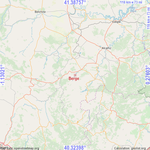
Berge GPS coordinates[2]
40° 51' 28.476" North, 0° 25' 37.524" West
| Map corner | latitude | longitude |
|---|---|---|
| Upper-left | 41.38757°, | -1.13021° |
| Center: | 40.85791°, | -0.42709° |
| Lower-right: | 40.32398°, | 0.27603° |
| Map W x H: | 118.3×118.3 km | = 73.5×73.5mi |
| max Lat: | 43.74134° ⇑54.8% North |
| Berge: | 40.85791° |
| min Lat: | ⇓45.2% South 27.64134° |
| min Long | Berge | max Long |
| -18.00367° | -0.42709° | 4.2899° |
| W 82.7%⇐ | ⇒17.3% E |
Elevation
Elevation of Berge is 727 m = 2385 ft, and this is 129 m = 423 ft above average elevation for this country.
| Max E: |
1682 m = 5518 ft | 42.4% |
| Berge | 727 m 2385 ft | |
| Avg. | 598 m = 1962 ft | |
Min E: |
0 m = 0 ft | 57.6% |
See also: Spain elevation on elevation.city.
Geographical zone
Berge is located in North temperate zone (between Tropic of Cancer and the Arctic Circle). Distance of this Northern Tropic circle is 1937.1 km =1203.7 mi to South.| Distance of | km | miles | from Berge |
|---|---|---|---|
| North Pole | 5464.1 | 3395.2 | to North |
| Arctic Circle | 2858.2 | 1776 | to North |
| Tropic Cancer | 1937.1 | 1203.7 | to South |
| Equator | 4543 | 2822.9 | to South |


Nearby cities:
15 places around Berge: (largest is in red/bold)
• Aguaviva
19.9 km =12.4 mi,  101°
101°
• Alcorisa
5.4 km =3.4 mi,  45°
45°
• Alloza
15.1 km =9.4 mi,  325°
325°
• Andorra
13.3 km =8.3 mi,  352°
352°
• Calanda
18.8 km =11.7 mi,  60°
60°
• Castellote
11.1 km =6.9 mi,  125°
125°
• Cañizar del Olivar
19 km =11.8 mi,  255°
255°
• Crivillén
12.9 km =8 mi,  282°
282°
• Ejulve
14 km =8.7 mi,  229°
229°
• Estercuel
17.2 km =10.7 mi,  268°
268°
• Foz-Calanda
15.4 km =9.6 mi, 62°
• Gargallo
13.5 km =8.4 mi, 259°
• Mas de las Matas
15.7 km =9.8 mi, 99°
• Molinos
4.5 km =2.8 mi,  205°
205°
• Seno
9 km =5.6 mi,  124°
124°
Sources, notices
• [Note1] Compared only with cities in Spain existing in our database
• [Src1] Map data: © OpenStreetMap contributors (CC-BY-SA)
• [Src2] Other city data from geonames.org with taken over terms of usage.
• [Src3] Geographical zone / Annual Mean Temperature by Robert A. Rohde @ Wikipedia
