Aguaviva geodata
Aguaviva (Aragon) is a seat of a third-order administrative division; located in Spain in Europe/Madrid (GMT+2) time zone. With population of 668 people, there are 3469 cities with bigger population in this country. Compared to other cities in Spain, 55.6% of cities are located further ↑North; 85.6% of cities are located further ←West and 59% of cities have higher elevation than Aguaviva. Note1


Aguaviva GPS coordinates[2]
40° 49' 19.596" North, 0° 11' 43.152" West
| Map corner | latitude | longitude |
|---|---|---|
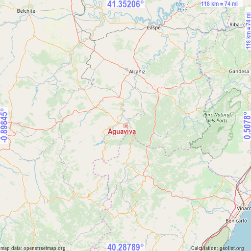
| Upper-left | 41.35206°, | -0.89845° |
| Center: | 40.82211°, | -0.19532° |
| Lower-right: | 40.28789°, | 0.5078° |
| Map W x H: | 118.3×118.3 km | = 73.5×73.5mi |
| max Lat: | 43.74134° ⇑55.6% North |
| Aguaviva: | 40.82211° |
| min Lat: | ⇓44.4% South 27.64134° |
| min Long | Aguaviva | max Long |
| -18.00367° | -0.19532° | 4.2899° |
| W 85.6%⇐ | ⇒14.4% E |
Elevation
Elevation of Aguaviva is 540 m = 1772 ft, and this is 58 m = 190 ft below average elevation for this country.
| Max E: |
1682 m = 5518 ft | 59% |
| Avg. | 598 m = 1962 ft | |
| Aguaviva | 540 m = 1772 ft | |
Min E: |
0 m = 0 ft | 41% |
See also: Spain elevation on elevation.city.
Geographical zone
Aguaviva is located in North temperate zone (between Tropic of Cancer and the Arctic Circle). Distance of this Northern Tropic circle is 1933.1 km =1201.2 mi to South.| Distance of | km | miles | from Aguaviva |
|---|---|---|---|
| North Pole | 5468.1 | 3397.7 | to North |
| Arctic Circle | 2862.2 | 1778.5 | to North |
| Tropic Cancer | 1933.1 | 1201.2 | to South |
| Equator | 4539 | 2820.4 | to South |


Nearby cities:
15 places around Aguaviva: (largest is in red/bold)
• Alcorisa
17.5 km =10.9 mi,  296°
296°
• Calanda
13.6 km =8.5 mi,  346°
346°
• Castellote
10.8 km =6.7 mi,  256°
256°
• Foz-Calanda
12.6 km =7.8 mi,  332°
332°
• Fórnoles
18 km =11.2 mi,  63°
63°
• La Ginebrosa
7.3 km =4.5 mi,  43°
43°
• Mas de las Matas
4.2 km =2.6 mi,  288°
288°
• Monroyo
14 km =8.7 mi,  105°
105°
• Palanques
11.7 km =7.3 mi,  173°
173°
• Seno
12.1 km =7.5 mi, 264°
• Torre de Arcas
13.2 km =8.2 mi,  126°
126°
• Torrecilla de Alcañiz
17.7 km =11 mi,  29°
29°
• Torrevelilla
11.4 km =7.1 mi, 39°
• Villores
16.4 km =10.2 mi,  181°
181°
• Zorita del Maestrazgo
10.7 km =6.6 mi, 166°
Sources, notices
• [Note1] Compared only with cities in Spain existing in our database
• [Src1] Map data: © OpenStreetMap contributors (CC-BY-SA)
• [Src2] Other city data from geonames.org with taken over terms of usage.
• [Src3] Geographical zone / Annual Mean Temperature by Robert A. Rohde @ Wikipedia
