Bagà geodata
Bagà (Catalonia) is a populated place; located in Spain in Europe/Madrid (GMT+2) time zone. With population of 2,178 people, there are 2063 cities with bigger population in this country. Compared to other cities in Spain, 80.6% of cities are located further ↓South; 92.9% of cities are located further ←West and 67.3% of cities have lower elevation than Bagà. Note1
Administrative division(s):
- Level 1: Catalonia
- Level 2: Província de Barcelona
- Level 3: Guardiola de Berguedà


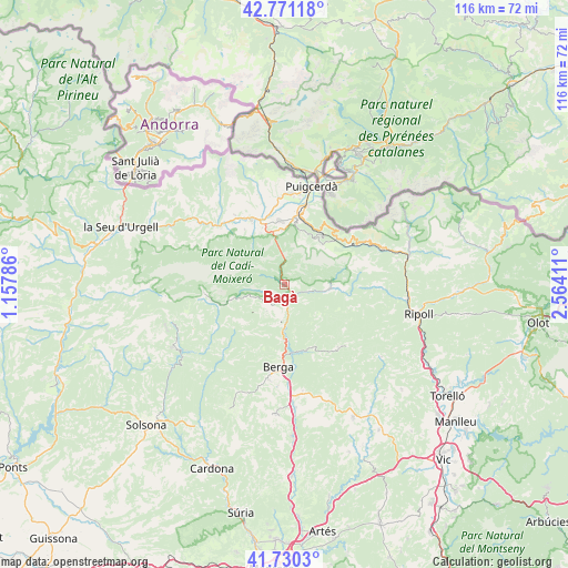
Bagà GPS coordinates[2]
42° 15' 10.404" North, 1° 51' 39.528" East
| Map corner | latitude | longitude |
|---|---|---|
| Upper-left | 42.77118°, | 1.15786° |
| Center: | 42.25289°, | 1.86098° |
| Lower-right: | 41.7303°, | 2.56411° |
| Map W x H: | 115.7×115.7 km | = 71.9×71.9mi |
| max Lat: | 43.74134° ⇑19.4% North |
| Bagà: | 42.25289° |
| min Lat: | ⇓80.6% South 27.64134° |
| min Long | Bagà | max Long |
| -18.00367° | 1.86098° | 4.2899° |
| W 92.9%⇐ | ⇒7.1% E |
Elevation
Elevation of Bagà is 794 m = 2605 ft, and this is 196 m = 643 ft above average elevation for this country.
| Max E: |
1682 m = 5518 ft | 32.7% |
| Bagà | 794 m 2605 ft | |
| Avg. | 598 m = 1962 ft | |
Min E: |
0 m = 0 ft | 67.3% |
See also: Spain elevation on elevation.city.
Geographical zone
Bagà is located in North temperate zone (between Tropic of Cancer and the Arctic Circle). Distance of this Northern Tropic circle is 2092.2 km =1300 mi to South.| Distance of | km | miles | from Bagà |
|---|---|---|---|
| North Pole | 5309 | 3298.9 | to North |
| Arctic Circle | 2703.1 | 1679.6 | to North |
| Tropic Cancer | 2092.2 | 1300 | to South |
| Equator | 4698.1 | 2919.3 | to South |


Nearby cities:
15 places around Bagà: (largest is in red/bold)
• Alp
13.5 km =8.4 mi,  9°
9°
• Bellver de Cerdanya
14.2 km =8.8 mi,  333°
333°
• Berga
16.6 km =10.3 mi,  184°
184°
• Castellar del Riu
16.1 km =10 mi,  206°
206°
• Das
12.1 km =7.5 mi,  3°
3°
• Guardiola de Berguedà
2.4 km =1.5 mi,  146°
146°
• Gósol
16.6 km =10.3 mi,  263°
263°
• Isòvol
14.3 km =8.9 mi,  345°
345°
• Riu de Cerdanya
10.7 km =6.6 mi,  344°
344°
• Saldes
10.7 km =6.6 mi, 258°
• Sant Julià de Cerdanyola
4.2 km =2.6 mi,  141°
141°
• Toses
14.9 km =9.3 mi,  59°
59°
• Urús
11 km =6.8 mi,  356°
356°
• Vallcebre
6.5 km =4 mi, 212°
• Vilada
14.1 km =8.8 mi,  155°
155°
Sources, notices
• [Note1] Compared only with cities in Spain existing in our database
• [Src1] Map data: © OpenStreetMap contributors (CC-BY-SA)
• [Src2] Other city data from geonames.org with taken over terms of usage.
• [Src3] Geographical zone / Annual Mean Temperature by Robert A. Rohde @ Wikipedia
