Montesclaros geodata
Montesclaros (Castille-La Mancha) is a seat of a third-order administrative division; located in Spain in Europe/Madrid (GMT+2) time zone. With population of 427 people, there are 4063 cities with bigger population in this country. Compared to other cities in Spain, 68.6% of cities are located further ↑North; 71.7% of cities are located further →East and 57.3% of cities have higher elevation than Montesclaros. Note1
Administrative division(s):
- Level 1: Castille-La Mancha
- Level 2: Province of Toledo
- Level 3: Montesclaros


Montesclaros GPS coordinates[2]
40° 6' 23.256" North, 4° 56' 18.564" West
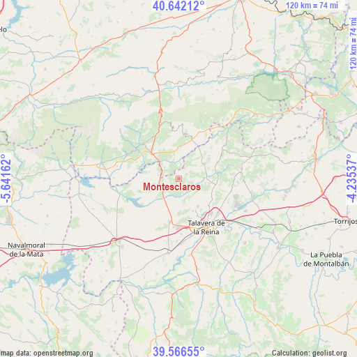
| Map corner | latitude | longitude |
|---|---|---|
| Upper-left | 40.64212°, | -5.64162° |
| Center: | 40.10646°, | -4.93849° |
| Lower-right: | 39.56655°, | -4.23537° |
| Map W x H: | 119.6×119.6 km | = 74.3×74.3mi |
| max Lat: | 43.74134° ⇑68.6% North |
| Montesclaros: | 40.10646° |
| min Lat: | ⇓31.4% South 27.64134° |
| min Long | Montesclaros | max Long |
| -18.00367° | -4.93849° | 4.2899° |
| W 28.3%⇐ | ⇒71.7% E |
Elevation
Elevation of Montesclaros is 559 m = 1834 ft, and this is 39 m = 128 ft below average elevation for this country.
| Max E: |
1682 m = 5518 ft | 57.3% |
| Avg. | 598 m = 1962 ft | |
| Montesclaros | 559 m = 1834 ft | |
Min E: |
0 m = 0 ft | 42.7% |
See also: Spain elevation on elevation.city.
Geographical zone
Montesclaros is located in North temperate zone (between Tropic of Cancer and the Arctic Circle). Distance of this Northern Tropic circle is 1853.5 km =1151.7 mi to South.| Distance of | km | miles | from Montesclaros |
|---|---|---|---|
| North Pole | 5547.6 | 3447.1 | to North |
| Arctic Circle | 2941.8 | 1827.9 | to North |
| Tropic Cancer | 1853.5 | 1151.7 | to South |
| Equator | 4459.4 | 2770.9 | to South |


Nearby cities:
15 places around Montesclaros: (largest is in red/bold)
• Arenas de San Pedro
17.1 km =10.6 mi,  312°
312°
• Buenaventura
10.9 km =6.8 mi,  43°
43°
• Cervera de los Montes
12.5 km =7.8 mi,  119°
119°
• Gamonal
16.3 km =10.1 mi,  186°
186°
• Lanzahita
11 km =6.8 mi,  1°
1°
• Mejorada
11.7 km =7.3 mi,  157°
157°
• Navalcán
13.1 km =8.1 mi,  250°
250°
• Navamorcuende
14.1 km =8.8 mi,  66°
66°
• Parrillas
11.7 km =7.3 mi, 245°
• Pedro Bernardo
15.3 km =9.5 mi,  9°
9°
• Santa Cruz del Valle
17 km =10.6 mi,  341°
341°
• Sartajada
17.1 km =10.6 mi,  45°
45°
• Segurilla
11.2 km =7 mi,  145°
145°
• Sotillo de las Palomas
9.5 km =5.9 mi,  91°
91°
• Velada
14.8 km =9.2 mi, 192°
Sources, notices
• [Note1] Compared only with cities in Spain existing in our database
• [Src1] Map data: © OpenStreetMap contributors (CC-BY-SA)
• [Src2] Other city data from geonames.org with taken over terms of usage.
• [Src3] Geographical zone / Annual Mean Temperature by Robert A. Rohde @ Wikipedia
