Alpedrete geodata
Alpedrete (Madrid) is a seat of a third-order administrative division; located in Spain in Europe/Madrid (GMT+2) time zone. With population of 12,797 people, there are 711 cities with bigger population in this country. Compared to other cities in Spain, 58.7% of cities are located further ↑North; 60.1% of cities are located further →East and 82.2% of cities have lower elevation than Alpedrete. Note1


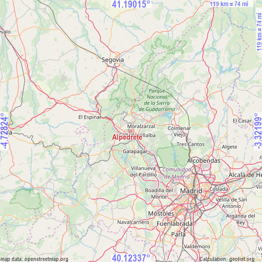
Alpedrete GPS coordinates[2]
40° 39' 32.004" North, 4° 1' 30.432" West
| Map corner | latitude | longitude |
|---|---|---|
| Upper-left | 41.19015°, | -4.72824° |
| Center: | 40.65889°, | -4.02512° |
| Lower-right: | 40.12337°, | -3.32199° |
| Map W x H: | 118.6×118.6 km | = 73.7×73.7mi |
| max Lat: | 43.74134° ⇑58.7% North |
| Alpedrete: | 40.65889° |
| min Lat: | ⇓41.3% South 27.64134° |
| min Long | Alpedrete | max Long |
| -18.00367° | -4.02512° | 4.2899° |
| W 39.9%⇐ | ⇒60.1% E |
Elevation
Elevation of Alpedrete is 919 m = 3015 ft, and this is 321 m = 1053 ft above average elevation for this country.
| Max E: |
1682 m = 5518 ft | 17.8% |
| Alpedrete | 919 m 3015 ft | |
| Avg. | 598 m = 1962 ft | |
Min E: |
0 m = 0 ft | 82.2% |
See also: Spain elevation on elevation.city.
Geographical zone
Alpedrete is located in North temperate zone (between Tropic of Cancer and the Arctic Circle). Distance of this Northern Tropic circle is 1914.9 km =1189.9 mi to South.| Distance of | km | miles | from Alpedrete |
|---|---|---|---|
| North Pole | 5486.2 | 3409 | to North |
| Arctic Circle | 2880.3 | 1789.7 | to North |
| Tropic Cancer | 1914.9 | 1189.9 | to South |
| Equator | 4520.8 | 2809.1 | to South |


Nearby cities:
15 places around Alpedrete: (largest is in red/bold)
• Becerril de la Sierra
7.2 km =4.5 mi,  25°
25°
• Boalo
11.1 km =6.9 mi,  55°
55°
• Cercedilla
9.5 km =5.9 mi,  343°
343°
• Collado Mediano
3.8 km =2.4 mi,  2°
2°
• Collado-Villalba
3.2 km =2 mi,  147°
147°
• Colmenarejo
10.9 km =6.8 mi,  176°
176°
• El Escorial
12.2 km =7.6 mi,  225°
225°
• Galapagar
9.1 km =5.7 mi,  168°
168°
• Guadarrama
5.6 km =3.5 mi,  285°
285°
• Hoyo de Manzanares
10.7 km =6.6 mi,  112°
112°
• Los Molinos
7.6 km =4.7 mi,  326°
326°
• Moralzarzal
5.1 km =3.2 mi, 64°
• Navacerrada
7.8 km =4.8 mi,  5°
5°
• Navalquejigo
6.1 km =3.8 mi,  199°
199°
• Torrelodones
12.4 km =7.7 mi,  137°
137°
Sources, notices
• [Note1] Compared only with cities in Spain existing in our database
• [Src1] Map data: © OpenStreetMap contributors (CC-BY-SA)
• [Src2] Other city data from geonames.org with taken over terms of usage.
• [Src3] Geographical zone / Annual Mean Temperature by Robert A. Rohde @ Wikipedia
