Guadarrama geodata
Guadarrama (Madrid) is a seat of a third-order administrative division; located in Spain in Europe/Madrid (GMT+2) time zone. With population of 14,800 people, there are 626 cities with bigger population in this country. Compared to other cities in Spain, 58.4% of cities are located further ↑North; 61.1% of cities are located further →East and 86.1% of cities have lower elevation than Guadarrama. Note1


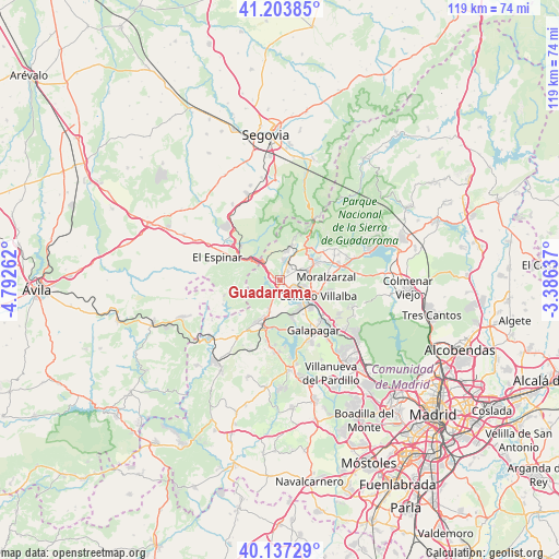
Guadarrama GPS coordinates[2]
40° 40' 21.72" North, 4° 5' 22.164" West
| Map corner | latitude | longitude |
|---|---|---|
| Upper-left | 41.20385°, | -4.79262° |
| Center: | 40.6727°, | -4.08949° |
| Lower-right: | 40.13729°, | -3.38637° |
| Map W x H: | 118.6×118.6 km | = 73.7×73.7mi |
| max Lat: | 43.74134° ⇑58.4% North |
| Guadarrama: | 40.6727° |
| min Lat: | ⇓41.6% South 27.64134° |
| min Long | Guadarrama | max Long |
| -18.00367° | -4.08949° | 4.2899° |
| W 38.9%⇐ | ⇒61.1% E |
Elevation
Elevation of Guadarrama is 966 m = 3169 ft, and this is 368 m = 1207 ft above average elevation for this country.
| Max E: |
1682 m = 5518 ft | 13.9% |
| Guadarrama | 966 m 3169 ft | |
| Avg. | 598 m = 1962 ft | |
Min E: |
0 m = 0 ft | 86.1% |
See also: Spain elevation on elevation.city.
Geographical zone
Guadarrama is located in North temperate zone (between Tropic of Cancer and the Arctic Circle). Distance of this Northern Tropic circle is 1916.5 km =1190.9 mi to South.| Distance of | km | miles | from Guadarrama |
|---|---|---|---|
| North Pole | 5484.7 | 3408 | to North |
| Arctic Circle | 2878.8 | 1788.8 | to North |
| Tropic Cancer | 1916.5 | 1190.9 | to South |
| Equator | 4522.4 | 2810.1 | to South |


Nearby cities:
15 places around Guadarrama: (largest is in red/bold)
• Alpedrete
5.6 km =3.5 mi,  105°
105°
• Becerril de la Sierra
9.8 km =6.1 mi,  59°
59°
• Boalo
15.4 km =9.6 mi,  71°
71°
• Cercedilla
8.1 km =5 mi,  20°
20°
• Collado Mediano
6.1 km =3.8 mi, 67°
• Collado-Villalba
8.3 km =5.2 mi,  120°
120°
• Colmenarejo
13.9 km =8.6 mi,  153°
153°
• El Escorial
10.6 km =6.6 mi,  198°
198°
• Galapagar
12.7 km =7.9 mi, 145°
• Los Molinos
5 km =3.1 mi, 15°
• Moralzarzal
10 km =6.2 mi,  86°
86°
• Navacerrada
8.8 km =5.5 mi,  44°
44°
• Navalquejigo
8 km =5 mi,  155°
155°
• Peguerinos
13.1 km =8.1 mi,  246°
246°
• San Lorenzo de El Escorial
10.3 km =6.4 mi,  208°
208°
Sources, notices
• [Note1] Compared only with cities in Spain existing in our database
• [Src1] Map data: © OpenStreetMap contributors (CC-BY-SA)
• [Src2] Other city data from geonames.org with taken over terms of usage.
• [Src3] Geographical zone / Annual Mean Temperature by Robert A. Rohde @ Wikipedia
