Alconchel de Ariza geodata
Alconchel de Ariza (Aragon) is a seat of a third-order administrative division; located in Spain in Europe/Madrid (GMT+2) time zone. With population of 124 people, there are 5647 cities with bigger population in this country. Compared to other cities in Spain, 53.1% of cities are located further ↓South; 65.8% of cities are located further ←West and 80% of cities have lower elevation than Alconchel de Ariza. Note1
Administrative division(s):
- Level 1: Aragon
- Level 2: Provincia de Zaragoza
- Level 3: Alconchel de Ariza


Alconchel de Ariza GPS coordinates[2]
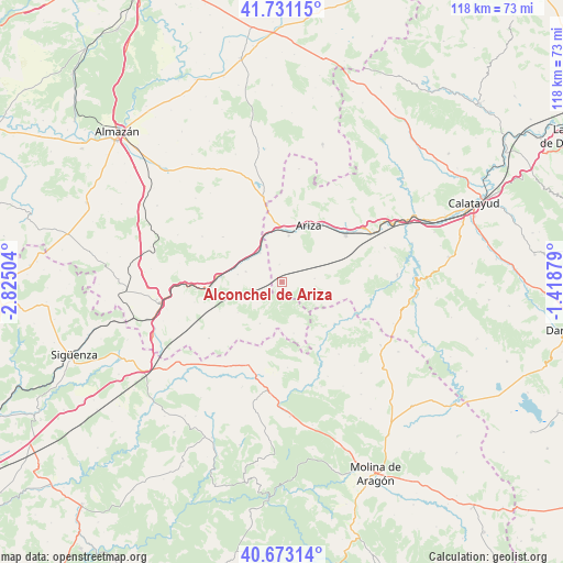
41° 12' 15.408" North, 2° 7' 18.876" West
| Map corner | latitude | longitude |
|---|---|---|
| Upper-left | 41.73115°, | -2.82504° |
| Center: | 41.20428°, | -2.12191° |
| Lower-right: | 40.67314°, | -1.41879° |
| Map W x H: | 117.6×117.6 km | = 73.1×73.1mi |
| max Lat: | 43.74134° ⇑46.9% North |
| Alconchel de Ariza: | 41.20428° |
| min Lat: | ⇓53.1% South 27.64134° |
| min Long | Alconchel de Ar | max Long |
| -18.00367° | -2.12191° | 4.2899° |
| W 65.8%⇐ | ⇒34.2% E |
Elevation
Elevation of Alconchel de Ariza is 897 m = 2943 ft, and this is 299 m = 981 ft above average elevation for this country.
| Max E: |
1682 m = 5518 ft | 20% |
| Alconchel de Ariza | 897 m 2943 ft | |
| Avg. | 598 m = 1962 ft | |
Min E: |
0 m = 0 ft | 80% |
See also: Spain elevation on elevation.city.
Geographical zone
Alconchel de Ariza is located in North temperate zone (between Tropic of Cancer and the Arctic Circle). Distance of this Northern Tropic circle is 1975.6 km =1227.6 mi to South.| Distance of | km | miles | from Alconchel de Ariza |
|---|---|---|---|
| North Pole | 5425.6 | 3371.3 | to North |
| Arctic Circle | 2819.7 | 1752.1 | to North |
| Tropic Cancer | 1975.6 | 1227.6 | to South |
| Equator | 4581.5 | 2846.8 | to South |


Nearby cities:
15 places around Alconchel de Ariza: (largest is in red/bold)
• Algar de Mesa
15.6 km =9.7 mi,  119°
119°
• Almaluez
15.5 km =9.6 mi,  307°
307°
• Arcos de Jalón
12.8 km =8 mi,  275°
275°
• Ariza
13.5 km =8.4 mi,  25°
25°
• Cabolafuente
6.8 km =4.2 mi,  84°
84°
• Calmarza
18.3 km =11.4 mi,  106°
106°
• Cetina
16.5 km =10.3 mi,  53°
53°
• Mochales
14.9 km =9.3 mi,  143°
143°
• Monreal de Ariza
9.8 km =6.1 mi,  8°
8°
• Monteagudo de las Vicarías
18.3 km =11.4 mi,  347°
347°
• Pozuel de Ariza
16.4 km =10.2 mi, 351°
• Santa María de Huerta
7.9 km =4.9 mi,  331°
331°
• Sisamón
10.5 km =6.5 mi, 110°
• Torrehermosa
3.7 km =2.3 mi, 352°
• Villel de Mesa
14 km =8.7 mi,  128°
128°
Sources, notices
• [Note1] Compared only with cities in Spain existing in our database
• [Src1] Map data: © OpenStreetMap contributors (CC-BY-SA)
• [Src2] Other city data from geonames.org with taken over terms of usage.
• [Src3] Geographical zone / Annual Mean Temperature by Robert A. Rohde @ Wikipedia
