Zorita del Maestrazgo geodata
Zorita del Maestrazgo (Valencia) is a seat of a third-order administrative division; located in Spain in Europe/Madrid (GMT+2) time zone. With population of 132 people, there are 5562 cities with bigger population in this country. Compared to other cities in Spain, 57.5% of cities are located further ↑North; 85.8% of cities are located further ←West and 50.1% of cities have higher elevation than Zorita del Maestrazgo. Note1
Administrative division(s):
- Level 1: Valencia
- Level 2: Província de Castelló
- Level 3: Zorita del Maestrazgo
Current local time in Zorita del Maestrazgo:
11:59 PM, ThursdayDifference from your time zone: hours


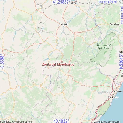
Zorita del Maestrazgo GPS coordinates[2]
40° 43' 41.412" North, 0° 10' 0.012" West
| Map corner | latitude | longitude |
|---|---|---|
| Upper-left | 41.25887°, | -0.8698° |
| Center: | 40.72817°, | -0.16667° |
| Lower-right: | 40.1932°, | 0.53645° |
| Map W x H: | 118.5×118.5 km | = 73.6×73.6mi |
| max Lat: | 43.74134° ⇑57.5% North |
| Zorita del Maestrazgo: | 40.72817° |
| min Lat: | ⇓42.5% South 27.64134° |
| min Long | Zorita del Maes | max Long |
| -18.00367° | -0.16667° | 4.2899° |
| W 85.8%⇐ | ⇒14.2% E |
Elevation
Elevation of Zorita del Maestrazgo is 656 m = 2152 ft, and this is 58 m = 190 ft above average elevation for this country.
| Max E: |
1682 m = 5518 ft | 50.1% |
| Zorita del Maestrazgo | 656 m 2152 ft | |
| Avg. | 598 m = 1962 ft | |
Min E: |
0 m = 0 ft | 49.9% |
See also: Spain elevation on elevation.city.
Geographical zone
Zorita del Maestrazgo is located in North temperate zone (between Tropic of Cancer and the Arctic Circle). Distance of this Northern Tropic circle is 1922.6 km =1194.6 mi to South.| Distance of | km | miles | from Zorita del Maestrazgo |
|---|---|---|---|
| North Pole | 5478.5 | 3404.2 | to North |
| Arctic Circle | 2872.6 | 1785 | to North |
| Tropic Cancer | 1922.6 | 1194.6 | to South |
| Equator | 4528.5 | 2813.9 | to South |


Nearby cities:
15 places around Zorita del Maestrazgo: (largest is in red/bold)
• Aguaviva
10.7 km =6.6 mi,  346°
346°
• Bordón
13.9 km =8.6 mi,  250°
250°
• Castellote
15.2 km =9.4 mi,  301°
301°
• Cinctorres
16.6 km =10.3 mi,  194°
194°
• Forcall
9.6 km =6 mi,  196°
196°
• Herbés
13.7 km =8.5 mi,  93°
93°
• La Ginebrosa
16 km =9.9 mi,  9°
9°
• Mas de las Matas
13.4 km =8.3 mi,  331°
331°
• Monroyo
12.9 km =8 mi,  59°
59°
• Morella
13.3 km =8.3 mi,  154°
154°
• Palanques
1.6 km =1 mi,  223°
223°
• Seno
17.2 km =10.7 mi, 302°
• Todolella
11.3 km =7 mi, 216°
• Torre de Arcas
8.6 km =5.3 mi,  72°
72°
• Villores
6.6 km =4.1 mi,  205°
205°
Sources, notices
• [Note1] Compared only with cities in Spain existing in our database
• [Src1] Map data: © OpenStreetMap contributors (CC-BY-SA)
• [Src2] Other city data from geonames.org with taken over terms of usage.
• [Src3] Geographical zone / Annual Mean Temperature by Robert A. Rohde @ Wikipedia
