Valdelacalzada geodata
Valdelacalzada (Extremadura) is a seat of a third-order administrative division; located in Spain in Europe/Madrid (GMT+2) time zone. With population of 2,700 people, there are 1817 cities with bigger population in this country. Compared to other cities in Spain, 82.3% of cities are located further ↑North; 92.8% of cities are located further →East and 82.1% of cities have higher elevation than Valdelacalzada. Note1
Administrative division(s):
- Level 1: Extremadura
- Level 2: Provincia de Badajoz
- Level 3: Valdelacalzada


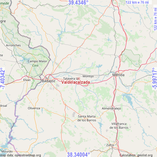
Valdelacalzada GPS coordinates[2]
38° 53' 21.948" North, 6° 42' 1.044" West
| Map corner | latitude | longitude |
|---|---|---|
| Upper-left | 39.4346°, | -7.40342° |
| Center: | 38.88943°, | -6.70029° |
| Lower-right: | 38.34004°, | -5.99717° |
| Map W x H: | 121.7×121.7 km | = 75.6×75.6mi |
| max Lat: | 43.74134° ⇑82.3% North |
| Valdelacalzada: | 38.88943° |
| min Lat: | ⇓17.7% South 27.64134° |
| min Long | Valdelacalzada | max Long |
| -18.00367° | -6.70029° | 4.2899° |
| W 7.2%⇐ | ⇒92.8% E |
Elevation
Elevation of Valdelacalzada is 184 m = 604 ft, and this is 414 m = 1358 ft below average elevation for this country.
| Max E: |
1682 m = 5518 ft | 82.1% |
| Avg. | 598 m = 1962 ft | |
| Valdelacalzada | 184 m = 604 ft | |
Min E: |
0 m = 0 ft | 17.9% |
See also: Spain elevation on elevation.city.
Geographical zone
Valdelacalzada is located in North temperate zone (between Tropic of Cancer and the Arctic Circle). Distance of this Northern Tropic circle is 1718.2 km =1067.6 mi to South.| Distance of | km | miles | from Valdelacalzada |
|---|---|---|---|
| North Pole | 5683 | 3531.3 | to North |
| Arctic Circle | 3077.1 | 1912 | to North |
| Tropic Cancer | 1718.2 | 1067.6 | to South |
| Equator | 4324.1 | 2686.9 | to South |


Nearby cities:
15 places around Valdelacalzada: (largest is in red/bold)
• Arroyo de San Serván
21.7 km =13.5 mi,  100°
100°
• Badajoz
23.4 km =14.5 mi,  266°
266°
• Corte de Peleas
18.3 km =11.4 mi,  171°
171°
• Entrín Bajo
19 km =11.8 mi,  183°
183°
• Esparragalejo
23.7 km =14.7 mi,  75°
75°
• La Albuera
21.9 km =13.6 mi,  209°
209°
• La Garrovilla
19.6 km =12.2 mi, 80°
• La Nava de Santiago
25.6 km =15.9 mi,  41°
41°
• La Roca de la Sierra
24.5 km =15.2 mi,  2°
2°
• Lobón
8 km =5 mi,  124°
124°
• Montijo
7.4 km =4.6 mi,  73°
73°
• Puebla de la Calzada
6.5 km =4 mi,  85°
85°
• Solana de los Barros
23 km =14.3 mi,  142°
142°
• Talavera La Real
6 km =3.7 mi,  257°
257°
• Torremayor
14.1 km =8.8 mi, 84°
Sources, notices
• [Note1] Compared only with cities in Spain existing in our database
• [Src1] Map data: © OpenStreetMap contributors (CC-BY-SA)
• [Src2] Other city data from geonames.org with taken over terms of usage.
• [Src3] Geographical zone / Annual Mean Temperature by Robert A. Rohde @ Wikipedia
