Talavera La Real geodata
Talavera La Real (Extremadura) is a populated place; located in Spain in Europe/Madrid (GMT+2) time zone. With population of 5,204 people, there are 1266 cities with bigger population in this country. Compared to other cities in Spain, 82.4% of cities are located further ↑North; 93.3% of cities are located further →East and 81.9% of cities have higher elevation than Talavera La Real. Note1
Administrative division(s):
- Level 1: Extremadura
- Level 2: Provincia de Badajoz
- Level 3: Talavera la Real


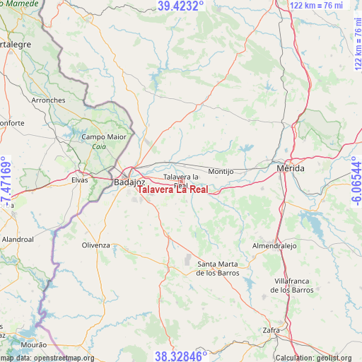
Talavera La Real GPS coordinates[2]
38° 52' 40.584" North, 6° 46' 6.816" West
| Map corner | latitude | longitude |
|---|---|---|
| Upper-left | 39.4232°, | -7.47169° |
| Center: | 38.87794°, | -6.76856° |
| Lower-right: | 38.32846°, | -6.06544° |
| Map W x H: | 121.7×121.7 km | = 75.6×75.6mi |
| max Lat: | 43.74134° ⇑82.4% North |
| Talavera La Real: | 38.87794° |
| min Lat: | ⇓17.6% South 27.64134° |
| min Long | Talavera La Rea | max Long |
| -18.00367° | -6.76856° | 4.2899° |
| W 6.7%⇐ | ⇒93.3% E |
Elevation
Elevation of Talavera La Real is 188 m = 617 ft, and this is 410 m = 1345 ft below average elevation for this country.
| Max E: |
1682 m = 5518 ft | 81.9% |
| Avg. | 598 m = 1962 ft | |
| Talavera La Real | 188 m = 617 ft | |
Min E: |
0 m = 0 ft | 18.1% |
See also: Spain elevation on elevation.city.
Geographical zone
Talavera La Real is located in North temperate zone (between Tropic of Cancer and the Arctic Circle). Distance of this Northern Tropic circle is 1716.9 km =1066.8 mi to South.| Distance of | km | miles | from Talavera La Real |
|---|---|---|---|
| North Pole | 5684.2 | 3532 | to North |
| Arctic Circle | 3078.4 | 1912.8 | to North |
| Tropic Cancer | 1716.9 | 1066.8 | to South |
| Equator | 4322.8 | 2686.1 | to South |


Nearby cities:
15 places around Talavera La Real: (largest is in red/bold)
• Arroyo de San Serván
27.4 km =17 mi,  95°
95°
• Badajoz
17.5 km =10.9 mi,  269°
269°
• Corte de Peleas
18.9 km =11.7 mi,  153°
153°
• Entrín Bajo
18.4 km =11.4 mi,  164°
164°
• La Albuera
18.4 km =11.4 mi,  194°
194°
• La Garrovilla
25.6 km =15.9 mi,  79°
79°
• La Roca de la Sierra
26.7 km =16.6 mi,  14°
14°
• Lobón
13 km =8.1 mi, 104°
• Montijo
13.5 km =8.4 mi, 75°
• Puebla de la Calzada
12.5 km =7.8 mi, 81°
• Solana de los Barros
26.2 km =16.3 mi,  130°
130°
• Torre de Miguel Sesmero
28.9 km =18 mi,  184°
184°
• Torremayor
20.1 km =12.5 mi, 82°
• Valdelacalzada
6 km =3.7 mi, 77°
• Villar del Rey
29.2 km =18.1 mi,  346°
346°
Sources, notices
• [Note1] Compared only with cities in Spain existing in our database
• [Src1] Map data: © OpenStreetMap contributors (CC-BY-SA)
• [Src2] Other city data from geonames.org with taken over terms of usage.
• [Src3] Geographical zone / Annual Mean Temperature by Robert A. Rohde @ Wikipedia
