Pasaia geodata
Pasaia (Basque Country) is a seat of a third-order administrative division; located in Spain in Europe/Madrid (GMT+2) time zone. With population of 15,990 people, there are 590 cities with bigger population in this country. Compared to other cities in Spain, 97.9% of cities are located further ↓South; 68.2% of cities are located further ←West and 98.4% of cities have higher elevation than Pasaia. Note1


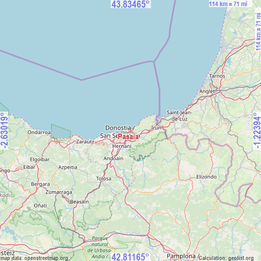
Pasaia GPS coordinates[2]
43° 19' 31.08" North, 1° 55' 37.452" West
| Map corner | latitude | longitude |
|---|---|---|
| Upper-left | 43.83465°, | -2.63019° |
| Center: | 43.3253°, | -1.92707° |
| Lower-right: | 42.81165°, | -1.22394° |
| Map W x H: | 113.7×113.7 km | = 70.6×70.6mi |
| max Lat: | 43.74134° ⇑2.1% North |
| Pasaia: | 43.3253° |
| min Lat: | ⇓97.9% South 27.64134° |
| min Long | Pasaia | max Long |
| -18.00367° | -1.92707° | 4.2899° |
| W 68.2%⇐ | ⇒31.8% E |
Elevation
Elevation of Pasaia is 10 m = 33 ft, and this is 588 m = 1929 ft below average elevation for this country.
| Max E: |
1682 m = 5518 ft | 98.4% |
| Avg. | 598 m = 1962 ft | |
| Pasaia | 10 m = 33 ft | |
Min E: |
0 m = 0 ft | 1.6% |
See also: Spain elevation on elevation.city.
Geographical zone
Pasaia is located in North temperate zone (between Tropic of Cancer and the Arctic Circle). Distance of this Northern Tropic circle is 2211.4 km =1374.1 mi to South.| Distance of | km | miles | from Pasaia |
|---|---|---|---|
| North Pole | 5189.7 | 3224.7 | to North |
| Arctic Circle | 2583.9 | 1605.6 | to North |
| Tropic Cancer | 2211.4 | 1374.1 | to South |
| Equator | 4817.3 | 2993.3 | to South |


Nearby cities:
15 places around Pasaia: (largest is in red/bold)
• Aduna
16.8 km =10.4 mi,  216°
216°
• Andoain
14.5 km =9 mi,  213°
213°
• Arano
14.2 km =8.8 mi,  169°
169°
• Astigarraga
5.1 km =3.2 mi,  197°
197°
• Donostia / San Sebastián
4.1 km =2.5 mi,  250°
250°
• Errenteria
2.5 km =1.6 mi,  126°
126°
• Hernani
7.7 km =4.8 mi, 211°
• Hondarribia
11.6 km =7.2 mi,  65°
65°
• Irun
11.2 km =7 mi,  82°
82°
• Lasarte
10 km =6.2 mi,  230°
230°
• Lezo
2.4 km =1.5 mi,  100°
100°
• Oria
10.7 km =6.6 mi, 223°
• Orio
16.9 km =10.5 mi, 252°
• Urnieta
10.1 km =6.3 mi, 210°
• Usurbil
11.5 km =7.1 mi,  238°
238°
Sources, notices
• [Note1] Compared only with cities in Spain existing in our database
• [Src1] Map data: © OpenStreetMap contributors (CC-BY-SA)
• [Src2] Other city data from geonames.org with taken over terms of usage.
• [Src3] Geographical zone / Annual Mean Temperature by Robert A. Rohde @ Wikipedia
