Pyhäjärvi geodata
Pyhäjärvi (Lapland) is a populated place; located in Finland in Europe/Helsinki (GMT+3) time zone. With population of 6,094 people, there are 173 cities with bigger population in this country. Compared to other cities in Finland, 97.6% of cities are located further ↓South; 81.6% of cities are located further ←West and 96.8% of cities have lower elevation than Pyhäjärvi. Note1


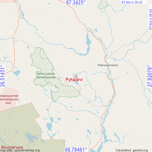
Pyhäjärvi GPS coordinates[2]
67° 4' 12.36" North, 27° 13' 3.468" East
| Map corner | latitude | longitude |
|---|---|---|
| Upper-left | 67.3425°, | 26.51451° |
| Center: | 67.0701°, | 27.21763° |
| Lower-right: | 66.79461°, | 27.92076° |
| Map W x H: | 60.9×60.9 km | = 37.8×37.8mi |
| max Lat: | 69.90864° ⇑2.4% North |
| Pyhäjärvi: | 67.0701° |
| min Lat: | ⇓97.6% South 59.83333° |
| min Long | Pyhäjärvi | max Long |
| 21.2° | 27.21763° | 30.93276° |
| W 81.6%⇐ | ⇒18.4% E |
Elevation
Elevation of Pyhäjärvi is 182 m = 597 ft, and this is 104.9 m = 344 ft above average elevation for this country.
| Max E: |
299 m = 981 ft | 3.2% |
| Pyhäjärvi | 182 m 597 ft | |
| Avg. | 77.1 m = 253 ft | |
Min E: |
1 m = 3 ft | 96.8% |
See also: Finland elevation on elevation.city.
Geographical zone
Pyhäjärvi is located in North Frigid zone (between North Pole and Arctic Circle). Distance of this North polar circle is 56.3 km =35 mi to South.| Distance of | km | miles | from Pyhäjärvi |
|---|---|---|---|
| North Pole | 2549.6 | 1584.2 | to North |
| Arctic Circle | 56.3 | 35 | to South |
| Tropic Cancer | 4851.6 | 3014.6 | to South |
| Equator | 7457.5 | 4633.9 | to South |


Nearby cities:
15 places around Pyhäjärvi: (largest is in red/bold)
• Kemijärvi
40.8 km =25.4 mi,  166°
166°
• Kittilä
119.4 km =74.2 mi,  303°
303°
• Kolari
151 km =93.8 mi,  281°
281°
• Kuusamo
150.4 km =93.5 mi,  144°
144°
• Levi
131.7 km =81.8 mi,  308°
308°
• Pelkosenniemi
13.5 km =8.4 mi,  70°
70°
• Pello
145.6 km =90.5 mi,  256°
256°
• Posio
114.9 km =71.4 mi,  158°
158°
• Ranua
131.8 km =81.9 mi,  193°
193°
• Rovaniemi
91.4 km =56.8 mi,  226°
226°
• Salla
68.4 km =42.5 mi,  112°
112°
• Savukoski
47.5 km =29.5 mi,  58°
58°
• Sodankylä
46.8 km =29.1 mi,  325°
325°
• Taivalkoski
173.4 km =107.7 mi, 164°
• Tervola
153.1 km =95.1 mi,  224°
224°
Sources, notices
• [Note1] Compared only with cities in Finland existing in our database
• [Src1] Map data: © OpenStreetMap contributors (CC-BY-SA)
• [Src2] Other city data from geonames.org with taken over terms of usage.
• [Src3] Geographical zone / Annual Mean Temperature by Robert A. Rohde @ Wikipedia
